What is recorded here
In pasture, close to E bank of river Deel. Approached by pathway from road to S. Rectangular graveyard (c. 35m E-W; c. 25m N-S) enclosed by low stone wall but with ruin of parish church of Grange forming NW corner. Still in use; earliest headstone noted dated 1777. Covering slab of 19th century chest tomb rests against S wall of church. Chamfered block of limestone, of late-medieval appearance, built into N graveyard wall.
In pasture, close to E bank of river Deel. Approached by pathway from road to S. Rectangular graveyard (c. 35m E-W; c. 25m N-S) enclosed by low stone wall but with ruin of parish church of Grange forming NW corner. Still in use; earliest headstone noted dated 1777. Covering slab of 19th century chest tomb rests against S wall of church. Chamfered block of limestone, of late-medieval appearance, built into N…
From the National Monuments Service (Archaeological Survey of Ireland) record LI036-040002
The monument record does not grant public access. Check the route and ask the landowner before entering private land.
- What survives
- Recorded monument
Places near here
Photo credits
- National Inventory of Architectural Heritage
- Mike Searle, Geograph · CC BY-SA 2.0
- Mike Searle, Wikimedia Commons · CC BY-SA 2.0
- Garry Dickinson, Geograph · CC BY-SA 2.0
- Willow, Wikimedia Commons · CC BY 2.5
- Created by Kglavin Modified Aug 2007 by Mike Christie, Wikimedia Commons · CC BY-SA 3.0
- A.-K. D., Wikimedia Commons · CC BY-SA 4.0
- Vadim Manuylov, Wikimedia Commons · CC BY-SA 3.0
 Grange HouseHouse · 226 ydBarrowBarrow, ditch barrow · 337 yd
 MoviddyHouse · 693 yd
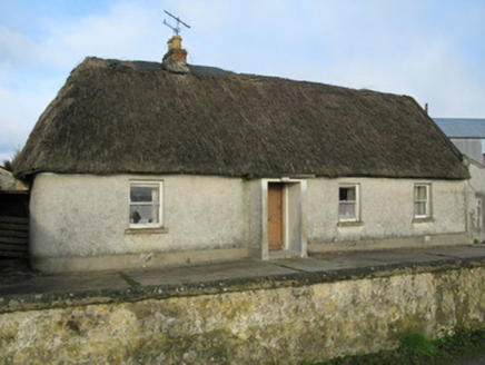 farm house1287 yd
 Knockaderry HouseCountry house · 1.2 mi
,_Newcastle_West,_Limerick_-_geograph.org.uk_-_1392672.jpg/250px-Castles_of_Munster,_Desmond_Hall_(Castle_Banqueting_Hall),_Newcastle_West,_Limerick_-_geograph.org.uk_-_1392672.jpg "Photo: Mike Searle, Wikimedia Commons · CC BY-SA 2.0") Templars Castle (in ruins)Castle, Anglo-Norman masonry castle · 2.1 mi
Templars Castle (in ruins)Castle, Anglo-Norman masonry castle · 2.1 mi Castle MahonCastle · 2.6 mi
 European ash2.9 mi
 Ardagh FortArchaeological place · 3.0 miSt. Luke's WellSpring · 3.4 mi
 Saint Ite's WellSpring · 6.1 mi
 Monterey Cypress11 mi
More archaeology and monuments in County Limerick · All of County Limerick
What do you know about this place?