What is recorded here
On gentle S-facing slope, c. 750 NNW of Newcastle West (LI036-067001-); on W side of road. Large, roughly rectangular graveyard (c. 100m N-S; c. 80m E-W), still in use and neatly maintained. South-of-centre is ruin of parish church (LI036-024001-) of Newcastle West, the E end of which is overlain by 18th and 19th century burial vaults including classical limestone Mausoleum. Scatter of 19th-century chest tombs to s of church. Numerous headstones, mostly 19th and 20th century (latter to N of church), but earliest headstone noted dated to 1770s.
On gentle S-facing slope, c. 750 NNW of Newcastle West (LI036-067001-); on W side of road. Large, roughly rectangular graveyard (c. 100m N-S; c. 80m E-W), still in use and neatly maintained. South-of-centre is ruin of parish church (LI036-024001-) of Newcastle West, the E end of which is overlain by 18th and 19th century burial vaults including classical limestone Mausoleum. Scatter of 19th-century chest tombs to…
From the National Monuments Service (Archaeological Survey of Ireland) record LI036-024002
The monument record does not grant public access. Check the route and ask the landowner before entering private land.
- What survives
- Recorded monument
Places near here
Photo credits
- National Inventory of Architectural Heritage
- Mike Searle, Wikimedia Commons · CC BY-SA 2.0
- Created by Kglavin Modified Aug 2007 by Mike Christie, Wikimedia Commons · CC BY-SA 3.0
- Garry Dickinson, Geograph · CC BY-SA 2.0
- Willow, Wikimedia Commons · CC BY 2.5
- A.-K. D., Wikimedia Commons · CC BY-SA 4.0
- jonleebotany, Wikimedia Commons · CC0
Enclosure in Castle DemesneEnclosure · 203 yd water pump276 ydbridge623 ydDooally BridgeBridge · 639 ydO'ConnorHouse · 683 ydTemplars Castle (in ruins)Castle, Anglo-Norman masonry castle · 906 ydArdagh FortArchaeological place · 2.6 miLimerick GreenwayWalking route · 3.2 miCastle MahonCastle · 3.4 miEuropean ash5.0 miSaint Ite's WellSpring · 5.2 miLawson's Cypress8.8 mi
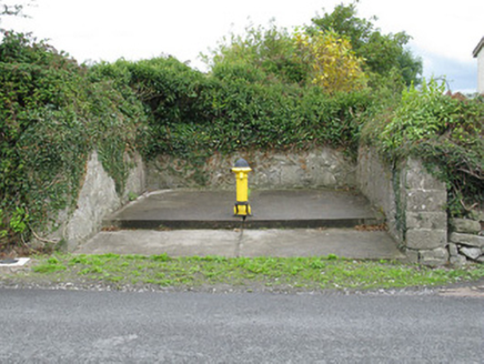 water pump276 yd
 bridge623 yd
 Dooally BridgeBridge · 639 yd
 O'ConnorHouse · 683 yd
,_Newcastle_West,_Limerick_-_geograph.org.uk_-_1392672.jpg/250px-Castles_of_Munster,_Desmond_Hall_(Castle_Banqueting_Hall),_Newcastle_West,_Limerick_-_geograph.org.uk_-_1392672.jpg "Photo: Mike Searle, Wikimedia Commons · CC BY-SA 2.0") Templars Castle (in ruins)Castle, Anglo-Norman masonry castle · 906 yd
Templars Castle (in ruins)Castle, Anglo-Norman masonry castle · 906 yd Ardagh FortArchaeological place · 2.6 miLimerick GreenwayWalking route · 3.2 mi
 Castle MahonCastle · 3.4 mi
 European ash5.0 mi
 Saint Ite's WellSpring · 5.2 mi
 Lawson's Cypress8.8 mi
More archaeology and monuments in County Limerick · All of County Limerick
What do you know about this place?