What is recorded here
In NE quadrant of embanked ovoid enclosure (LI029-121--*). Sub-circular area (diam. c. 10m) enclosed by low earth and stone bank (H 0.2m). This area covered by dense overgrowth of trees and bushes, but no grave markers appear to be present. Described in 1840 as a 'Children's Burial ground' (OSNB No 85, 239).
From the National Monuments Service (Archaeological Survey of Ireland) record LI030-031002
The monument record does not grant public access. Check the route and ask the landowner before entering private land.
- What survives
- Recorded monument
Places near here
Photo credits
- Mike Searle, Wikimedia Commons · CC BY-SA 2.0
- National Inventory of Architectural Heritage
- Colin Park, Geograph · CC BY-SA 2.0
- Mike Searle, Geograph · Creative Commons Attribution-ShareAlike 2.0
- SteveODowd, Wikimedia Commons · CC BY-SA 4.0
- Willow, Wikimedia Commons · CC BY 2.5
- EecherplazGinkgo06.jpg : Cayambe derivative work: Ginkgotree ( talk ), Wikimedia Commons · CC BY-SA 3.0
 Lissamota CastleCastle · 1161 yd
 Ballynahaha HouseGates/railings/walls · 1294 yd
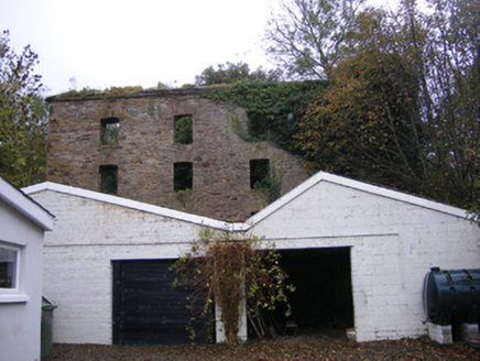 mill (water)1303 ydBurial Ground1.1 miLismoylan - HachuredFairy fort / earthen ringfort · 1.3 miFamine stoneMemorial · 1.5 mi
 KnockfeerinaMountain / peak · 2.0 miFlat cemetery in Kiltenan SouthFlat cemetery · 2.1 mi
 Clonshire CastleCastle · 3.9 mi
 Dysert AenghusaHeritage attraction · 4.5 mi
 European ash4.9 mi
 Ginkgo5.3 mi
More archaeology and monuments in County Limerick · All of County Limerick
What do you know about this place?