What is recorded here
In pasture on N-facing slope. Burial ground inaccessible due to heavy overgrowth.
From the National Monuments Service (Archaeological Survey of Ireland) record CO118-033
The monument record does not grant public access. Check the route and ask the landowner before entering private land.
- What survives
- Recorded monument
Places near here
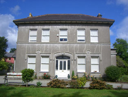 Rock HouseHouse · 313 yd
 Bantry Post OfficeOfficially recorded historic building · 375 yd
 Tourist OfficeVisitor information · 533 yd
 Statue of Wolfe ToneMemorial · 550 ydGraveyard in TownlotsGraveyard · 606 yd
 Bantry HouseStables · 910 yd
 Bantry HouseHeritage attraction · 978 yd
 Ginkgo1226 ydGinkgo1243 ydEcclesiastical enclosure in KilnaruaneEcclesiastical enclosure · 1282 yd
 Monumental PillarCross · 1290 ydSeskin ViewViewpoint · 1333 yd
Pictures: National Inventory of Architectural Heritage; Mike Searle, Geograph · CC BY-SA 2.0; Kenneth Allen, Geograph · CC BY-SA 2.0; N Chadwick, Geograph · CC BY-SA 2.0; Zairon, Wikimedia Commons · CC BY 4.0; EecherplazGinkgo06.jpg : Cayambe derivative work: Ginkgotree ( talk ), Wikimedia Commons · CC BY-SA 3.0; Andreas F. Borchert, Wikimedia Commons · CC BY-SA 4.0
More archaeology and monuments in County Cork · All of County Cork
What do you know about this place?