What is recorded here
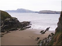
In rough pasture, on NW-facing slope at W edge of Horse Island. Marked 'Old Burial Ground' on OS 6-inch map (1842). Roughly sub-rectangular field (c. 50m NE-SW; c. 31m NW-SE) defined by coastal cliff to NW and W. At SW side built up against steep NW-facing slope, are series of earthen banks (H c. 0.8m) enclosing three rectangular areas c. 8m wide (NW-SE) and 25m, 10m and 15m in length, from NE-SW, respectively. On more gently sloping ground to NW, 7m in from cliff edge, is upright stone (H 0.5m; 0.41m x 0.1m) aligned NW-SE. According to local tradition one of the McCarthy-Townsends buried here.
In rough pasture, on NW-facing slope at W edge of Horse Island. Marked 'Old Burial Ground' on OS 6-inch map (1842). Roughly sub-rectangular field (c. 50m NE-SW; c. 31m NW-SE) defined by coastal cliff to NW and W. At SW side built up against steep NW-facing slope, are series of earthen banks (H c. 0.8m) enclosing three rectangular areas c. 8m wide (NW-SE) and 25m, 10m and 15m in length, from NE-SW, respectively.…
From the National Monuments Service (Archaeological Survey of Ireland) record CO151-036
The monument record does not grant public access. Check the route and ask the landowner before entering private land.
- What survives
- Recorded monument
Places near here
Photo credits
- onview, Wikimedia Commons · CC BY-SA 3.0
- Gordon Hatton, Geograph · CC BY-SA 2.0
- National Inventory of Architectural Heritage
Horse IslandIslet · 142 ydFlea IslandIslet · 315 yd Battle of CastlehavenNaval battle · 710 ydThe BatteryFortification · 806 ydHut site in CastlehavenHut site · 960 ydFaill ÁrdCliff · 982 ydSandy CoveBeach / strand · 1121 ydCastlehaven CastleCastle · 1136 ydPlacenames & Their Amazing StoriesHeritage attraction · 1156 ydCastlehaven StrandBeach / strand · 1190 ydgate lodge1238 ydCastlehaven HouseRectory/glebe/vicarage/curate's house · 1250 yd
 Battle of CastlehavenNaval battle · 710 ydThe BatteryFortification · 806 ydHut site in CastlehavenHut site · 960 ydFaill ÁrdCliff · 982 yd
 Sandy CoveBeach / strand · 1121 ydCastlehaven CastleCastle · 1136 ydPlacenames & Their Amazing StoriesHeritage attraction · 1156 yd
 Castlehaven StrandBeach / strand · 1190 yd
 gate lodge1238 yd
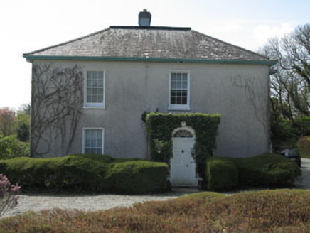 Castlehaven HouseRectory/glebe/vicarage/curate's house · 1250 yd
More archaeology and monuments in County Cork · All of County Cork
What do you know about this place?