What is recorded here
Small promontory at mouth of inlet projecting E into Castlehaven. Neck defined by two rock cut fosses leaving an intervening ridge (H 1.2m). Possible draw-bridge support. Inner fosse (Wth 4m) flat bottomed; defined on seaward side by vertical rock face (H c. 3.5m) with low ramp at S end. Warrant issued 1651 to Co. Richard Townshend (Porter 1984, 130) describes construction of new fortification to defend Castlehaven which probably refers to this site. No visible surface trace of structure described within.
Small promontory at mouth of inlet projecting E into Castlehaven. Neck defined by two rock cut fosses leaving an intervening ridge (H 1.2m). Possible draw-bridge support. Inner fosse (Wth 4m) flat bottomed; defined on seaward side by vertical rock face (H c. 3.5m) with low ramp at S end. Warrant issued 1651 to Co. Richard Townshend (Porter 1984, 130) describes construction of new fortification to defend…
From the National Monuments Service (Archaeological Survey of Ireland) record CO151-015
The monument record does not grant public access. Check the route and ask the landowner before entering private land.
- What survives
- Recorded monument
Places near here
Photo credits
- Gordon Hatton, Geograph · CC BY-SA 2.0
- onview, Wikimedia Commons · CC BY-SA 3.0
- National Inventory of Architectural Heritage
- Superbass, Wikimedia Commons · CC BY-SA 4.0
- Kondephy, Wikimedia Commons · CC BY-SA 4.0
- Christian Pirkl, Wikimedia Commons · CC BY-SA 3.0 at
- Mike Searle, Wikimedia Commons · CC BY-SA 2.0
Castlehaven CastleCastle · 448 yd Castlehaven StrandBeach / strand · 499 ydFlea IslandIslet · 593 ydGleann BearcháinWood · 614 ydBattle of CastlehavenNaval battle · 667 ydCastlehaven HouseRectory/glebe/vicarage/curate's house · 714 ydgate lodge748 ydSandy CoveBeach / strand · 1381 ydIndicatedFairy fort / stone ringfort · 1549 ydCnoc DromaArchaeological place · 1552 ydSycamore1692 ydCastle TownshendCastle · 1.1 mi
 Castlehaven StrandBeach / strand · 499 ydFlea IslandIslet · 593 ydGleann BearcháinWood · 614 yd
 Battle of CastlehavenNaval battle · 667 yd
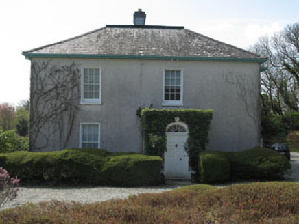 Castlehaven HouseRectory/glebe/vicarage/curate's house · 714 yd
 gate lodge748 yd
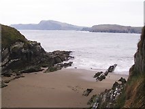 Sandy CoveBeach / strand · 1381 yd
 IndicatedFairy fort / stone ringfort · 1549 yd
 Cnoc DromaArchaeological place · 1552 yd
 Sycamore1692 yd
 Castle TownshendCastle · 1.1 mi
More archaeology and monuments in County Cork · All of County Cork
What do you know about this place?