
What is recorded here
Freestanding single-bay single-storey flat-roofed lookout post ["LOP"], between 1939-42, on an elongated half-octagonal plan. Now disused. Flat reinforced concrete roof. Rendered mass- or reinforced concrete block walls. Square-headed window openings with concrete sills, and concealed dressings with no fittings…
Read the whole record
From the Buildings of Ireland (National Inventory of Architectural Heritage) record 31305303
Places near here
Photo credits
- Colin Park, Wikimedia Commons · CC BY-SA 2.0
- Matthew Chadwick, Geograph · CC BY-SA 2.0
- National Inventory of Architectural Heritage
- Maker not stated on source page, www.tripadvisor.co.uk
- Eoghan888, Wikimedia Commons · CC0
- Colin Park, Geograph · CC BY-SA 2.0
- Maker not stated on source page, www.dreamstime.com
- Kiran Madhusudhanan, Wikimedia Commons · CC BY-SA 4.0
- N Chadwick, Geograph · CC BY-SA 2.0
- Maker not stated on source page, www.atlasobscura.com
 Moyteoge HeadMountain / peak · 52 yd
Explorer Tom Moyteoge Head was once used to smuggle illegal cheese across the bay in a rowboat. The customs officer never found out…
 Keem BeachBeach / strand · 671 yd
Explorer Tom Keem Beach sits at the end of an Achill road in a horseshoe bay, with steep green slopes crowding around a surprisingly…
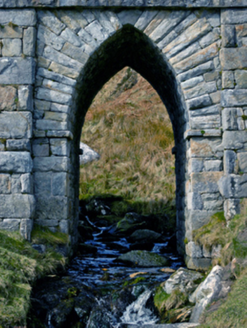 bridge718 yd
Explorer Tom Bridge in Keel West crosses a stream so small the Vikings got lost looking for it. It’s got a pointed arch that looks…
 Ogham stone in Keel WestOgham stone · 787 yd
Explorer Tom The Ogham stone in Keel West would post 'Just weathering life' on its social media account every single day. It’s got…
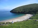 Keem BayVisitor information · 847 yd
Explorer Tom Keem Bay has its New Year’s resolution to stop being so windy, but it fails every time. It’s beautiful, yeah, but also…
 Croaghaun sw TopMountain / peak · 1.3 mi
Explorer Tom Croaghaun sw Top was saved by a hero nobody remembers, who probably just stopped looking in the wrong direction for…
 CroaghaunMountain / peak · 1.5 mi
Explorer Tom Croaghaun hides its big cliffs behind the mountain. Show-off. Croaghaun is Achill Island's highest mountain at 688…
 Megalithic tomb in SlievemoreMegalithic tomb · 3.4 mi
Explorer Tom Megalithic tomb in Slievemore is playing possum on the map. The surveyors clearly got drunk and drew it three fields…
 Convent of the Sacred HeartConvent/nunnery · 4.1 mi
Explorer Tom Convent of the Sacred Heart in Keel East is guarding a legend about a giant who slept in the garden. The sisters…
 Achill Island - AcaillIsland · 4.6 mi
Explorer Tom If I say Achill is a quick detour, hide my car keys. Achill is Ireland's largest island, yet you can arrive without…
 The Deserted Village at SlievemoreVisitor information · 5.5 mi
Explorer Tom The Deserted Village at Slievemore is haunted by ghosts who are mostly just annoyed about the lack of broadband, but…
 Slievemore New CemeteryCemetery · 5.5 mi
Explorer Tom Slievemore New Cemetery in Mayo has a superstition where you must tip your hat to every stone or you’ll lose your left…
More historic places in County Mayo · All of County Mayo

What do you know about this place?Tap to add a comment or ask a question