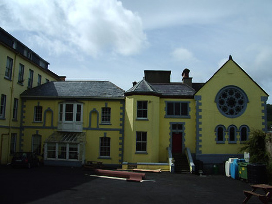
What is recorded here
Detached L-plan convent and chapel complex, comprising three-bay two-storey former house of c.1820 with glazed porch addition, L-plan block to west of 1893-5 having three-bay façade with entrance bay recessed between canted bay and gable front of chapel, and sixteen-bay three-storey with attic block to east. Now in use as social housing. Half-hipped roof to former house, hipped and pitched roofs to east and west blocks, with slate and artificial slate, with ridge cresting to chapel, rendered and red brick chimneystacks, cast-iron rainwater goods, and with recent flat-roofed dormers to east block. Former house has painted rendered walls with render quoins, platband, and empty niches to first floor, segmental-headed window openings with stone sills and timber sliding sash six-over-six pane windows, timber sliding sash one-over-one pane oriel window to former house, with timber apron panels. West block has square-headed window openings, one triple-light with block-and-start surround with stone sills and two-over-two pane sliding sash windows. Round-headed window openings to chapel,with stone tracery to rear and east walls, triple-light window with roll mouldings to façade, with dressed stone block-and-start surrounds. Rose window to chapel façade with stone tracery and roll moulding. Tripartite windows to south elevation of east block. Square-headed entrance opening to east block with dressed stone block-and-start surround, timber panelled door and mullion to overlight. Accessed via stone steps. Glazed entrance porch to former house with round-headed door opening with moulded surround. Rubble limestone boundary walls having coursed dressed limestone piers with moulded cornices and bases and wrought-iron double leaf entrance gates.
Much of the characteristic fabric is retained to this convent and chapel complex, which has lively front and rear elevations due to a variety of openings. This distinguishes it from the plain elevations of the massive east block and allows it to continue as the focal point of this large site which reaches from the Main Street down to the banks of the Suir.
This does not grant access. Most recorded buildings are privately owned; view them only from public ground unless the owner allows entry.
Places near here
 Bank of Irelandbank/financial institution · 68 yd
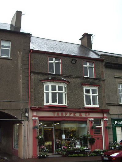 Taaffe and Companyhouse · 88 yd
 Town WallTown defences · 328 yd
 Ormonde CastleHeritage attraction · 364 yd
 CastleCastle, Anglo-Norman masonry castle · 365 yd
 Maurice DavinMonument · 653 yd
 CarrigfenoaghMountain / peak · 1.4 mi
 Coolnamuck Castke (in Ruins)Castle, tower house · 2.1 mi
 Coolnamuck Wood WestForest · 2.8 mi
 Tower HillMountain / peak · 3.1 mi
 Thomas KielyMemorial · 3.2 mi
 Tower Hill WoodWood · 3.6 mi
Other information
Photo: National Inventory of Architectural Heritage · Website use allowed for educational or private purposes with source credit