What is recorded here
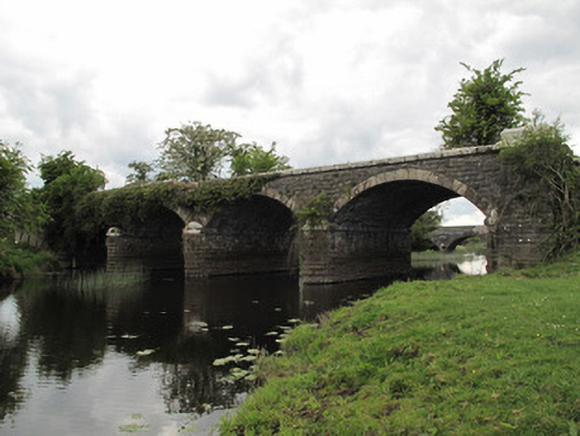
Bridge in Tullyhumphry carries four arches and enough railway company names to start a row over who paid for dinner. It belonged to the Ulster Railway’s Cavan branch, was opened by Clones and Cavan, and built and worked by Dundalk and Enniskillen. The River Finn wisely stayed out of it.
Four-arch railway bridge, built c.1860, carrying Clones and Cavan Extension Railway over River Finn. Segmental arches with dressed V-jointed voussoirs and squared coursed snecked rubble stone to soffits. V-shaped cutwaters having rounded stone capping to each elevation of piers. Dressed chamfered sandstone plat-band at impost level of each arch, continuing around cut-waters. Narrow stone string course to base of each cutwater. Tapered stone buttresses to abutment to each elevation. Roughly coursed rock-faced rusticated stone to spandrel walls, buttresses, abutments, piers and cut-waters. Margined quoins. Chamfered dressed sandstone plat-band, surmounted by dressed sandstone parapet walls, missing to some of east elevation, raised capping over buttresses.
This substantial and elegantly-composed bridge fulfilled an important function in carrying the railway over the River Finn and provided a connection between counties Monaghan and Fermanagh. It formed a component part of the Cavan Branch of the Ulster Railway, later the Great Northern Railway, which was opened by the Clones and Cavan Extension Railway, but built and worked by the Dundalk and Enniskillen Railway. Dressed sandstone detailing to voussoirs, plat-bands, and parapets articulate each elevation and provide a contrast to the rock-faced stone of the spandrel and abutment wall, producing an appealing textural visual affect. This bridge makes an aesthetically-pleasing focal point in the landscape, forms a group with the road bridge nearby, and is an important reminder of the railway heritage of the area.
From the Buildings of Ireland (National Inventory of Architectural Heritage) record 41401624
This does not grant access. Most recorded buildings are privately owned; view them only from public ground unless the owner allows entry.
Places near here
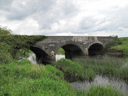 Annaghmullin BridgeBridge · 53 yd
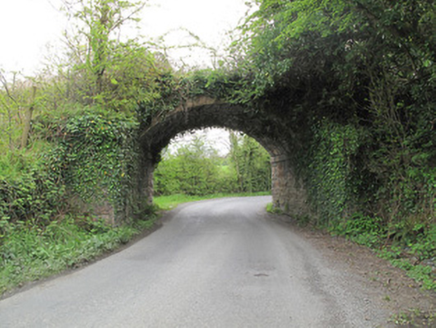 bridge158 ydHoly WellSpring · 935 ydClonandraMountain / peak · 1219 ydRuinsHouse, fortified house · 1.0 mi
 Sycamore1.1 mi
 European Yew1.1 mi
 Castle SaundersonCastle, unclassified · 2.0 mi
 Ulster Canal Stores Visitor CentreHeritage attraction · 5.3 mi
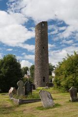 Round Tower5.4 mi
 Shrine in CrossmoyleShrine · 5.4 mi
 The Cassandra Hand CentreMuseum · 5.5 mi
Pictures: National Inventory of Architectural Heritage; Christian Pirkl, Wikimedia Commons · CC BY-SA 3.0 at; Sitomon, Wikimedia Commons · CC BY-SA 2.0; Mike Searle, Geograph · CC BY-SA 2.0; Kenneth Allen, Geograph · CC BY-SA 2.0; Andreas F. Borchert, Wikimedia Commons · CC BY-SA 4.0
More historic places in County Monaghan · All of County Monaghan
What do you know about this place?