What is recorded here
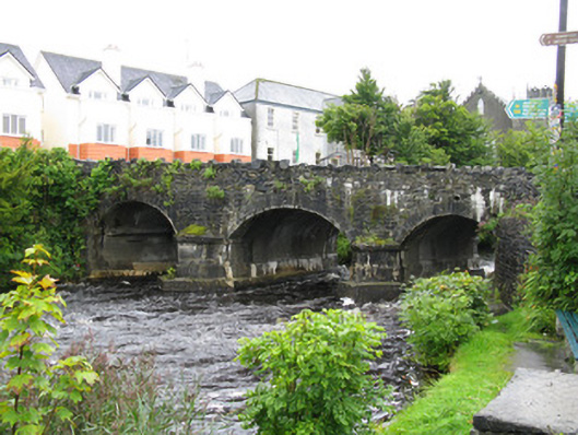
Bridge in Canrawer East has castle battlements along the top and little pyramids on its river piers. Someone was asked to get people across the water and came back with a modest proposal to rule Egypt.
Triple-span rubble limestone road bridge, dated 1820. Segmental arches with tooled voussoirs with raised keystones. Gunnelled soffits with rendered plinths for arch springing. Tooled V-cutwaters to river piers with pyramidal caps, on rendered bases. Roughly coursed hammer-dressed stonework to parapets with crenellated copings.
Part of Alexander Nimmo's road improvement scheme between Galway and Clifden, this fine stone bridge is also a significant and picturesque landmark on the river. The fine cutwaters and arch voussoirs display good masonry, serving to illustrate the high quality of construction that allows the bridge to continue to fulfil its original function in the twenty-first century.
From the Buildings of Ireland (National Inventory of Architectural Heritage) record 30326008
This does not grant access. Most recorded buildings are privately owned; view them only from public ground unless the owner allows entry.
Places near here
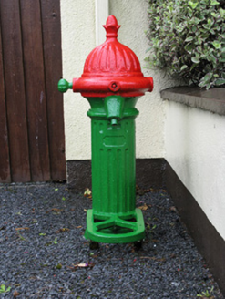 water pump37 yd
 Catholic Church of the Immaculate ConceptionChurch/chapel · 72 ydSt. Michaels WellHoly well · 182 ydTobernavannia (Site of)Holy well · 461 yd
 Owenriff WayWalking route · 637 ydCastleCastle, unclassified · 804 ydInis Dáith BhuíIslet · 1.4 miNewvillage ForestForest · 1.9 miGlengowla Mines MuseumMuseum · 2.0 mi
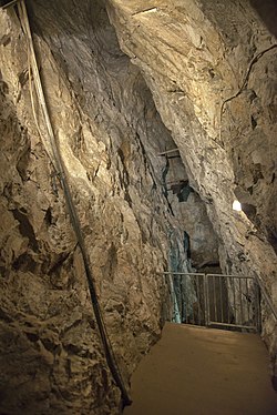 Glengowla MinesHeritage attraction · 2.1 mi
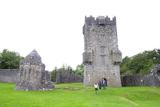 Aughnanure Castle (in ruins)Castle, tower house · 2.2 mi
 Inis an GhaillIsland · 4.0 mi
Pictures: National Inventory of Architectural Heritage; Graham Horn, Geograph · CC BY-SA 2.0; Maigheach-gheal, Geograph · CC BY-SA 2.0; andrew mcmillan, Wikimedia Commons · CC BY 3.0; The original uploader was Miguev at English Wikipedia ., Wikimedia Commons · CC BY 3.0; Rick Crowley, Wikimedia Commons · CC BY-SA 2.0
More historic places in County Galway · All of County Galway
What do you know about this place?