DDiscover AloneMapAbout

Bridge in Cloghaneleesh

Bridge

What is recorded here

Ballingarry Castle. The earliest part of this structure was possibly constructed around 1280 by the Cantillon family. According to sources (Barrington, 1976), it resembled a modern version of a promontory fort (KE008-006001-), consisting of a gateway with adjoining curtain walls. The early remains consist of a…

Read the whole record
Ballingarry Castle. The earliest part of this structure was possibly constructed around 1280 by the Cantillon family. According to sources (Barrington, 1976), it resembled a modern version of a promontory fort (KE008-006001-), consisting of a gateway with adjoining curtain walls. The early remains consist of a semi-circular bank on the mainland, measuring c 120m long and c 10m wide. In 1585 Ballingarry and other lands belonging to the Cantillons were granted to George Isham, who left the occupants undisturbed, taking only the head rents. However, by 1602 Garrett Roe Stack, brother-in-law to Lord Kerry, garrisoned Ballingarry, and Sir Charles Wilmot put the castle under siege for over a year. In 1603 Gerald Mac Morris surrendered the castle and was executed, along with some of the leaders. During the Cromwellian wars Ballingarry Castle came under Colonel David Crosbie, a loyalist, who, according to Smith (1756), built a small castle. At this time Ballingarry was not confined to the isthmus. Crosbie extended the fortress by constructing the two trenches that lead to the drawbridge, and he also built several houses on the peninsula to house English families. Extended in order to withstand the attacks of the Irish, Crosbie was able to secure the castle with the help of his friend Lord Inchiquin of Clare, who provided the garrison with food and ammunition. Drawbridge (KE008-006003-): crossing the deep chasm, there is a strong stone wall with cut-stone corners cut into the cliff. It contains a loophole which had a wide inward splay, and beside this is a small aumbry. The stone fortification is c 8.5m to the S and 3.9m to the E. The wall is c 1.6m in thickness. A tower once lead to the drawbridge by a stairway or slope, but this has since been filled in. Dingle. Brandon in association with FAS Training and Employment Authority (1995), no. 1000.

From the National Monuments Service (Archaeological Survey of Ireland) record KE008-006003

The monument record does not grant public access. Check the route and ask the landowner before entering private land.

What do you know about this place?Tap to add a comment or ask a question

What you write will be public.

Places near here

Photo credits
  • kevin higgins, Wikimedia Commons · CC BY-SA 2.0
  • National Inventory of Architectural Heritage
  • Ridiculopathy, Wikimedia Commons · CC0
  • Nedbrowne, Wikimedia Commons · CC0
Promontory fortPromontory fort, coastal · 59 yd

Explorer Tom Promontory fort in Cloghaneleesh would rate visitors three stars. They’re too loud and they wear trainers on ancient…

Settlement cluster in CloghaneleeshSettlement cluster · 84 yd

Explorer Tom Settlement cluster in Cloghaneleesh hides a hidden message in its stones if you squint hard enough. It’s basically a…

Fortification in CloghaneleeshFortification · 101 yd

Explorer Tom Fortification in Cloghaneleesh took about four million cups of tea to build. Seriously, the stains are everywhere now.…

Site of Ballingarry CastleCastle, unclassified · 184 yd

Explorer Tom Site of Ballingarry Castle in Cloghaneleesh has been lost for so long it’s like a ghost who forgot where it haunts. The…

Castle Shannon (in ruins)Castle, unclassified · 1558 yd

Explorer Tom Castle Shannon in Castleshannon is gone completely, except for the dog that now thinks it owns the whole history book.…

Inshaboy PointHeadland · 1.4 mi

Explorer Tom Inshaboy Point claims a royal visit happened here once, but nobody can find any proof other than a muddy boot print and…
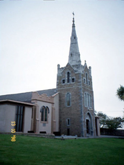
Saint Mary's Catholic ChurchChurch/chapel · 2.3 mi

Explorer Tom Saint Mary's Catholic Church in Booleenshare was built where a poet fell into a ditch and wrote a sonnet. The tower…

Catholic Church of the Sacred HeartChurch/chapel · 5.1 mi

Explorer Tom Catholic Church of the Sacred Heart in Kilmoyly South is stuck in a fairy dispute over parking rights. The apse is…

CloghaunHut site · 25 mi

Explorer Tom Cloghaun is proud of its one surviving wall, having lost its twin in a mysterious argument. It's an oval drystone thing…

Hachured, CloghaunFairy fort / earthen ringfort · 25 mi

Explorer Tom Cloghaun in Baile Na Bhfionnúrach is incredibly proud of its view, even though it’s just a circle with one stone wall…

Cathair na BhFionnúrachArchaeological place · 25 mi

Explorer Tom At the foot of Mount Brandon, Cathair na BhFionnúrach has a stone wall sturdy enough to make Tom suspect the local…

Hachured, CathairFairy fort / stone ringfort · 25 mi

Explorer Tom Cathair in Baile Na Bhfionnúrach is where a local priest lost a bet involving a goat and a very expensive hat. It’s…

More historic places in County Kerry · All of County Kerry

Add to this placeAdd a picture Add a detailed tip Add a story

Explore the map1,095,414 places to discover

Next place · or swipePromontory fort