What is recorded here
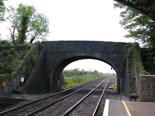
Archival Description [Demolished 2008]: Single-arch bridge over railway line, opened 1846. Part ivy-covered snecked limestone walls between snecked limestone battered abutment walls with cut-limestone stringcourses supporting benchmark-inscribed parapets having cut-limestone coping. Single elliptical arch with margined rock faced limestone ashlar radiating voussoirs. Sited spanning railway line with unkempt banks to railway line.
Archival Appraisal [Demolished 2008]: A bridge identified as an integral component of the mid nineteenth-century civil engineering heritage of south County Dublin on account of the connections with the development of the Great Southern and Western Railway (GSWR) line opened (1846) by the Great Southern and Western Railway (GSWR) Company with the architectural value of the composition suggested not only by the rock faced dressings demonstrating good quality workmanship, but also by the elegant "sweep" of the arch making a pleasing visual statement at a crossing over the railway line: meanwhile, a discreet benchmark remains of additional interest for the connections with cartography and the preparation of maps by the Ordnance Survey (established 1824).
From the Buildings of Ireland (National Inventory of Architectural Heritage) record 11207002
This does not grant access. Most recorded buildings are privately owned; view them only from public ground unless the owner allows entry.
Places near here
Photo credits
- National Inventory of Architectural Heritage
- Nigel Thompson, Geograph · Creative Commons Attribution-ShareAlike 2.0
- JP, Geograph · CC BY-SA 2.0
- Superchilum, Wikimedia Commons · CC BY-SA 4.0
- Alvesgaspar, Wikimedia Commons · CC BY-SA 3.0
- Mike Searle, Geograph · CC BY-SA 2.0
- DiggingSpace, Wikimedia Commons · CC BY-SA 4.0
- Ian Paterson, Geograph · CC BY-SA 2.0
- Branaigh, Wikimedia Commons · CC BY-SA 4.0
 Hazelhatch and Celbridge Railway StationFoot bridge · 31 yd
 Hazelhatch and Celbridge Railway StationRailway station · 63 ydEarthwork in RingwoodEarthwork · 230 ydEnclosure in RingwoodEnclosure · 422 yd
 Grand Canal WayWalking route · 1.1 mi
 Oriental plane1.3 miJohn McLaughlinMemorial · 1.3 mi
 Common Lime1.5 mi
 CastleCastle, tower house · 1.8 mi
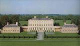 Castletown HouseHeritage attraction · 1.9 mi
 Reeves CastleCastle · 1.9 mi
 Battle of GlenmamaMajor battlefield · 2.5 mi
More historic places in County Dublin · All of County Dublin
What do you know about this place?