What is recorded here
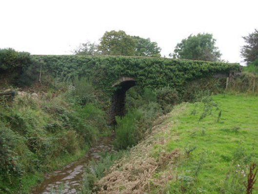
Single-arch bridge, built c. 1895, carrying road over the former Stranorlar to Glenties railway line. Railway line now out of use with tracks removed (c. 1952). Segmental-headed arch with mildly rock-faced ashlar limestone voussoirs to arch, and with roughly squared rubble stone construction to arch barrel. Coursed and snecked rock-faced squared rubble stone construction to spandrels and to parapets; cement capping to parapets. Tarmacadam deck with grass verges. Located to the north-west/west of Ballybofey, and to the south of Cloghan. Sited adjacent to the north-west of the former Cloghan Railway Station (see 40906802).
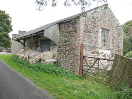
This former railway bridge retains its early form and character despite the closure of the railway line in 1952. The good-quality mildly rock-faced masonry used in its construction is typical of Victorian railway engineering and architecture in Ireland. It survives in good condition, which is testament to the quality of its original construction, the skill of the masons involved, and the grandiose long-term ambitions of the railway company that originally constructed it. It was originally built by the County Donegal Joint Railway Committee as part of the Stranorlar to Glenties narrow gauge (3-foot) railway line, which opened on the March 1895 and closed to passengers in 1947 and closed completely in 1952. This railway bridge forms part of a group of structures associated with this railway line along the Finn Valley, and it is an integral element of the built heritage and transport history of County Donegal. It forms a pair of related structures along with the former railway goods shed to the south-east.
From the Buildings of Ireland (National Inventory of Architectural Heritage) record 40906806
This does not grant access. Most recorded buildings are privately owned; view them only from public ground unless the owner allows entry.
Places near here
Photo credits
- National Inventory of Architectural Heritage
- Richard Webb, Geograph · CC BY-SA 2.0
- Kenneth Allen, Geograph · CC BY-SA 2.0
- Wanfried-Dublin, Wikimedia Commons · CC BY-SA 4.0
- Willie Duffin, Geograph · CC BY-SA 2.0
- Robert Bone, Wikimedia Commons · CC BY-SA 2.0
- Dr Neil Clifton, Geograph · CC BY-SA 2.0
- Me, Wikimedia Commons · Public domain
- D Gore, Geograph · CC BY-SA 2.0
- Kenneth Allen, Wikimedia Commons · CC BY-SA 2.0
- Andreas F. Borchert, Wikimedia Commons · CC BY-SA 3.0 de
 store/warehouse166 yd
 Cloghan BridgeBridge · 197 yd
 AltnapasteMountain / peak · 1.1 mi
 Gorey HillMountain / peak · 2.8 mi
 Standing StonesPortal tomb · 5.9 mi
 Drumboe WoodForest recreation place · 6.4 mi
 Giant's Grave Megalithic TombMegalithic tomb · 8.3 mi
 Newmills Corn and Flax MillsHeritage attraction · 8.6 mi
 Battle of ScarrifholisBattle · 9.0 mi
 Ard na Mona WoodOfficial walking route · 9.5 mi
 Stackarnagh Abbey GraveyardGraveyard · 10 mi
 Station IslandIsland · 15 mi
More historic places in County Donegal · All of County Donegal
What do you know about this place?