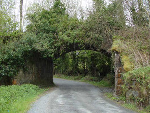
What is recorded here
Single-arch masonry railway bridge, built c.1850, carrying Dundalk to Enniskillen Branch of former Ulster Railway over road. Segmental arch with rock-faced rusticated sandstone voussoirs and random rubble stone to soffit. Squared stone parapet walls, with dressed stone copings. Rock-faced rusticated spandrels and…
Read the whole record
From the Buildings of Ireland (National Inventory of Architectural Heritage) record 41401816
Places near here
Photo credits
- National Inventory of Architectural Heritage
- Wanfried-Dublin, Wikimedia Commons · CC BY 4.0
- Enda O Flaherty, Wikimedia Commons · CC BY-SA 2.0
- This file is from the Mechanical Curator collection , a set of over 1 million images scanned from out-of-copyright books and released to Flickr Commons by the British Library. View image on Flickr View all images from book View catalogue entry for book ., Wikimedia Commons · Public domain
- D Gore, Geograph · CC BY-SA 2.0
- James O'Neill, Wikimedia Commons · CC BY-SA 4.0
- Oliver Dixon, Geograph · CC BY-SA 2.0
- Eric Jones, Geograph · CC BY-SA 2.0
- Dean Molyneaux, Geograph · CC BY-SA 2.0
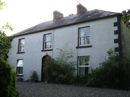 FairviewHouse · 338 yd
Explorer Tom Fairview in Corraskea has a boot scraper that’s seen more mud than a farmer’s wellies after a storm. The most dramatic event ever was a pigeon landing on the roof and looking annoyed at it. Just wave from the road and imagine you’re the owner of this grand old place.
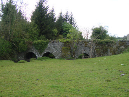 bridge1163 yd
Explorer Tom Bridge in Edenaferkin was built by someone who thought three arches wasn’t enough and added a fourth for good measure. The builder probably thought, 'Let's make this river crossable and also a bit fancy'. Have a nosey, polite as ever.
 Portal tomb in LennanPortal tomb · 3.8 mi
Explorer Tom Portal tomb in Lennan is perched on a drumlin ridge, looking slightly tipsy from the wind. If it could order at a chipper, it’d just want a stone and some silence. Stand on the spot and imagine the gossip it's heard.
 Giants GreveWedge tomb · 4.3 mi
Explorer Tom "Giants Greve is hiding a scandal about a stone that wasn’t invited to the party. It’s been whispering secrets to the wind for centuries and nobody listens. Snap one photo, then put the phone away and actually look."
 Dartrey ForestForest · 5.3 mi
 Flagpole HillMountain / peak · 5.9 mi
 Battle of ClontibretBattlefield · 6.9 mi
 Bush IslandIslet · 9.9 mi
Explorer Tom Bush Island might actually be a hidden crannog in Lough Sillan, waiting for us to discover its secret, mossy, ancient history today.
 Irish Hunger StrikersMemorial · 17 mi
Explorer Tom This memorial for Irish Hunger Strikers is a powerful tribute to the volunteers who stood firm in H-Block for their beliefs.
 Aughanduff Upper MountainMountain / peak · 17 mi
Explorer Tom Climb up to see the slope above Glenmore Road from this distinct peak in County Armagh, shall we?
 Post-med Church; Graveyard: Ballymoyer Old Church or Lisdromaude in BallintemplePost-med Church · 18 mi
Explorer Tom Ballymoyer Old Church in Ballintemple has two names because it couldn’t decide which one was cooler. The road leading there probably hates it a bit. Ideal place to rehearse an excuse for being late to church.
 Ballymoyer WoodWood · 19 mi
Explorer Tom Ballymoyer Wood near Whitecross, where I imagine the car park serves as a cozy starting point for quiet walks.
More historic places in County Monaghan · All of County Monaghan

What do you know about this place?Tap to add a comment or ask a question