
What is recorded here
From the Buildings of Ireland (National Inventory of Architectural Heritage) record 41305001
Places near here
Photo credits
- National Inventory of Architectural Heritage
- Maker not stated on source page, www.pinterest.com
- Maker not stated on source page, pl.pinterest.com
- Kieran Campbell, Geograph · Creative Commons Attribution-ShareAlike 2.0
- Colin McMahon, Wikimedia Commons · CC BY-SA 4.0
- Maker not stated on source page, id.pinterest.com
- Maker not stated on source page, tr.pinterest.com
- Eric Jones, Geograph · CC BY-SA 2.0
- Killeevan Sarsfields GAA / Smart Lotto; individual photographer not stated, smartlotto.ie
- Alvesgaspar, Wikimedia Commons · CC BY-SA 3.0
- Maker not stated on source page, onefabday.com
 bridge1 yd
Explorer Tom Bridge in Corkeeran is overgrown and sitting there like it’s waiting for a train that’s never coming back. A goat once…
 Fairy fort / earthen ringfort in DavaghFairy fort / earthen ringfort · 348 yd
Explorer Tom Liscussee in Cussee would tell its younger self to stop worrying about the hedge and start enjoying the slope. It’s a…
 Earthwork in Corkeeran (dartree By., Killeevan Par.)Earthwork · 356 yd
Explorer Tom Earthwork in Corkeeran has a favourite song, but only cows can hear it. A house now sits where the fort used to be…
 Grave YardGraveyard · 671 yd
Explorer Tom Killeevan Glebe graveyard is D-shaped because the map makers were drunk one Tuesday afternoon and couldn’t decide on a…
 RuinsChurch · 684 yd
Explorer Tom Ruins in Killeevan Glebe had a poet fall in the ditch nearby who never did recover his dignity. The bones found here…
 Killeevan Abbey GraveyardGraveyard · 686 yd
Explorer Tom Killeevan Abbey Graveyard in Monaghan started because two lads made a bet in the pub that they could find a spot with…
 Standing stone in Killeevan GlebeStanding stone · 729 yd
Explorer Tom Standing stone in Killeevan Glebe thinks Dublin tourists are loud, badly dressed, and smell faintly of overpriced…
 Fairy fort / earthen ringfort in KillygoneFairy fort / earthen ringfort · 754 yd
Explorer Tom Fairy fort / earthen ringfort in Killygone claims it has hidden treasure, but it's definitely just an old biscuit tin…
 Saint Laebhan's Church (Killeevan)Church/chapel · 755 yd
Explorer Tom Saint Laebhan's Church (Killeevan) sits on an elevated site, giving it a bit of a dramatic view while keeping its…
 Sarsfields Park, Kileevan SarsfieldsGAA ground · 1073 yd
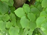 Common Lime1667 yd
Explorer Tom This Common Lime in County Monaghan keeps whispering to its younger self about making better leaf choices. It’s got…
 CastleCastle, unclassified · 1.0 mi
Explorer Tom Castle in Killycoonagh is teaching history by example, showing how quickly a local legend can fade into a nice memory…
More historic places in County Monaghan · All of County Monaghan

What do you know about this place?Tap to add a comment or ask a question