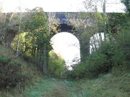
What is recorded here
Three-arch road bridge over railway line, begun 1891; opened 1892; extant 1893. Tuck pointed snecked rock faced limestone walls centred on ivy-covered piers with rock faced cut-limestone stringcourses supporting parapets having lichen-covered rock faced cut-limestone coping. Series of three round arches with drag…
Read the whole record
Three-arch road bridge over railway line, begun 1891; opened 1892; extant 1893. Tuck pointed snecked rock faced limestone walls centred on ivy-covered piers with rock faced cut-limestone stringcourses supporting parapets having lichen-covered rock faced cut-limestone coping. Series of three round arches with drag edged rock faced limestone ashlar voussoirs centred on drag edged rock faced cut-limestone keystones. Sited spanning uprooted railway line with unkempt embankments to railway line.
A viaduct-like bridge identified as an important component of the late nineteenth-century civil engineering heritage of the rural environs of Claremorris on account of the connections with the development of the Claremorris and Ballinrobe Branch of the Midland Great Western Railway (MGWR) line (opened 1892) by the Ballinrobe and Claremorris Light Railway Company (formed 1884; absorbed 1924) with the architectural value of the composition confirmed not only by the rock faced surface finish demonstrating good quality workmanship, but also by the lofty "sweep" of the arches making a dramatic visual statement at a crossing over the now-uprooted railway line.
From the Buildings of Ireland (National Inventory of Architectural Heritage) record 31310113
Places near here
Picture notes
- Computer-made picture. It does not show this monument.
- National Inventory of Architectural Heritage
- Computer-made picture. It does not show this playground.
 Knocknacaltragh Burial GroundChildren's burial ground · 199 ydComputer-made picture
 Children's burial ground in CaltraghChildren's burial ground · 368 ydComputer-made picture
 IndicatedEnclosure · 450 ydComputer-made picture
 Lis moreArchaeological place · 490 ydComputer-made picture
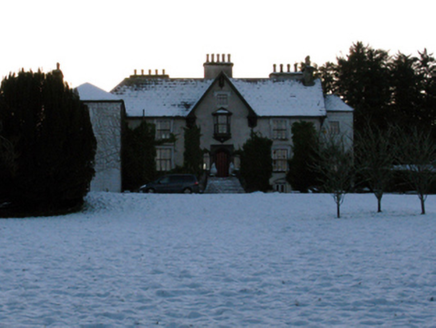 BrookhillCountry house · 1243 yd
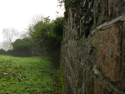 Carradoyne HouseWalled garden · 1337 yd
 Children's playground1.1 miComputer-made picture
 Crannog in Clare,mayfieldCrannog · 1.1 miComputer-made picture
 Settlement cluster in Carrowbeg East,carrowbeg WestSettlement cluster · 1.1 miComputer-made picture
 Crannog in MayfieldCrannog · 1.1 miComputer-made picture
 Crannog in ClareCrannog · 1.2 miComputer-made picture
 M. KilleenHouse · 1.2 mi
More historic places in County Mayo · All of County Mayo

What do you know about this place?Tap to add a comment or ask a question