What is recorded here
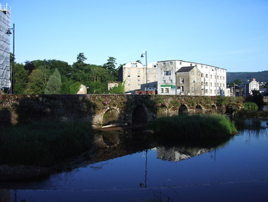
Road bridge spanning two branches of River Suir, built c.1750 on site of medieval bridge, consisting of two separate sections, six arches to north-west and three-arches to south-east, northern side of latter having one visible arch. Round arches to main bridge, with dressed stone voussoirs, random rubble stone walls and parapets with round-profile limestone copings, having V-cutwaters to north, upstream elevation. Segmental arches to south-eastern section, with dressed stone voussoirs and rubble walls with cut-limestone copings. Weir in branch of river to north of main bridge, having sluice between branches.
This long curving bridge is an excellent example of eighteenth-century construction, on the site of earlier bridges. The sluice and wer to the eastern side of the bridge link it with the large milling complex to the north-west of the bridge. The scenic qualities of the site are maximised by having a walkway, and a public green space along the eastern bank of the River Suir beside Cahir Castle.
From the Buildings of Ireland (National Inventory of Architectural Heritage) record 22111032
This does not grant access. Most recorded buildings are privately owned; view them only from public ground unless the owner allows entry.
Places near here
Photo credits
- Benutzer:StefanServos, Wikimedia Commons · CC BY-SA 3.0
- Chris Allen, Geograph · CC BY-SA 2.0
- National Inventory of Architectural Heritage
- Chmouel Boudjnah Original uploader was Chmouel at fr.wikipedia, Wikimedia Commons · CC BY-SA 3.0
- Algirdas at Lithuanian Wikipedia, Wikimedia Commons · Public domain
- Sitomon, Wikimedia Commons · CC BY-SA 2.0
- Mike Searle, Geograph · CC BY-SA 2.0
- Sarah777, transferred by Lvova, Wikimedia Commons · Public domain
- Martin Richard Phelan, Geograph · CC BY-SA 2.0
 Cahir CastleCastle · 68 yd
 Cahir MillsMill (water) · 82 yd
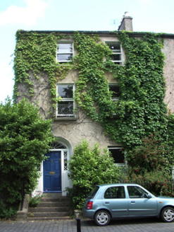 The Mall HouseHouse · 90 yd
 Cahir CastleHeritage attraction · 94 ydSiege of Cahir CastleSiege · 195 ydLadys WellHoly well · 455 yd
 Pedunculate Oak1564 yd
 European Yew1.2 mi
 Coolbane Castle (in ruins)Castle, tower house · 2.4 mi
 Knockgraffon MotteArchaeological place · 2.6 mi
 Knockgraffon MoatCastle, motte and bailey · 2.6 miSlieveanard ne TopMountain / peak · 3.0 mi
More historic places in County Tipperary · All of County Tipperary
What do you know about this place?