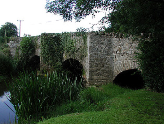
What is recorded here
Four-arch humpback limestone road bridge over Nenagh River, northeastern arch serving millrace, built c.1700 and widened c.1750. Comprises segmental arches to northwest elevation with roughly-dressed voussoirs and variously round, slightly-pointed round and pointed segmental arches to southeast. Rubble parapets, having three V-plan refuges to southwest side on V-plan cut-waters. Straight joint to underside of bridge is evidence of widening towards northwest.
This road bridge is a significant part of a grouping of architecturally-significant structures at Ballynaclough. Its main interest lies in the retention of features from two periods of construction, in particular the pedestrian refuges, which are a rare survival.
From the Buildings of Ireland (National Inventory of Architectural Heritage) record 22402703
This does not grant access. Most recorded buildings are privately owned; view them only from public ground unless the owner allows entry.
Places near here
Photo credits
- National Inventory of Architectural Heritage
- David P Howard, Geograph · Creative Commons Attribution-ShareAlike 2.0
- Miguel Angel Masegosa Martínez, Wikimedia Commons · CC BY 2.0
- P L Chadwick, Geograph · Creative Commons Attribution-ShareAlike 2.0
- Colin Park, Geograph · CC BY-SA 2.0
- Gramscis cousin at English Wikipedia, Wikimedia Commons · CC BY-SA 3.0
- Jonjobaker, Wikimedia Commons · CC BY-SA 4.0
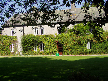 Ballynaclogh HouseHouse · 65 yd
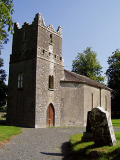 Ballynaclogh ChurchChurch/chapel · 149 ydGibbet HillMountain / peak · 1219 yd
 Church (in Ruins)Graveyard · 2.9 mi
 Sweet Chestnut2.9 mi
 Kilmore Church (in Ruins), GraveyardGraveyard · 3.0 mi
 CastleCastle, Anglo-Norman masonry castle · 3.2 mi
 Nenagh CastleCastle · 3.2 miOld BarracksHeritage attraction · 3.2 mi
 Nenagh Heritage CentreMuseum · 3.3 miKnockacraheen HillMountain / peak · 3.5 mi
 Silvermines ViewpointViewpoint · 4.0 mi
More historic places in County Tipperary · All of County Tipperary
What do you know about this place?