
Places near here
Photo credits
- National Inventory of Architectural Heritage
- Willow, Wikimedia Commons · CC BY 2.5
- Nigel Thompson, Wikimedia Commons · CC BY-SA 2.0
- Mike Searle, Wikimedia Commons · CC BY-SA 2.0
- Christian Pirkl, Wikimedia Commons · CC BY-SA 3.0 at
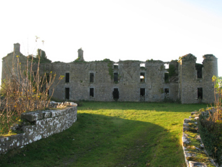 Ballinrobe Cavalry BarracksBarracks · 67 yd
Explorer Tom Ballinrobe Cavalry Barracks has a family tree that’s mostly made up of old men in shakos. It’s a shell now, but it still marches in its sleep every night at two. Count the crows, then count the bricks to keep your mind sharp.
 canal (section of)79 yd
Explorer Tom Ballinrobe Demesne’s canal started because two lads made a bet in the pub about who could dig furthest. It’s part of famine relief work, which makes it both heroic and slightly desperate. Practise your rowing on dry land if you’re feeling particularly ambitious today.
RathkellyFairy fort / earthen ringfort · 381 ydExplorer Tom Rathkelly is a fairy fort with a bank only as tall as my knee, which feels like a serious insult to its status. If it had a dating profile, it would say 'short but sturdy' and get zero likes from the modern crowd. Bring your map, get completely lost anyway, because that is definitely the fun part here.
 European ash406 yd
Explorer Tom European ash is what the builder was really thinking when he decided to chop down the perfect straight timber for the roof beams. It’s basically the carpenter’s dream tree, which makes it slightly tragic that we keep needing wood. Take the long way round, it deserves the effort.
LabbadermotCave · 1.7 miExplorer Tom Labbadermot in County Mayo hates tourists from Galway because they always ask if it rhymes with 'badger mot', which is honestly not far off the mark. It’s a cave that wants to be left alone but pretends to be welcoming for some reason, like a grumpy uncle at a party. Visit, then text me what you think. I'll pretend to read it.
Castle Hag RockIslet · 2.8 miExplorer Tom Castle Hag Rock thinks its secret talent is holding its breath while the waves try to drown it. It’s built on a rock, which is a bit circular, like saying 'it’s wet because it’s water.' The whole thing looks like it’s mid-yawn, ready to drop its jaw into the Atlantic. Find the wonkiest bit of it and send a photo straight to your group chat for maximum confusion.
Long IslandIslet · 3.0 miExplorer Tom Long Island in Mayo has a curse that only affects people who don’t wave back, so keep your arm moving or suffer the consequences. It’s not as long as it looks either; that’s just the sea being dramatic about its own depth. Pop by and tell it it's looking well.
 Neale CemeteryCemetery · 3.0 mi
Explorer Tom Neale Cemetery in Mayo was supposedly invented by a local lad who just needed somewhere to park his tractor, apparently. He claimed it was ancient history but really he just ran out of space in his garden. It’s the ideal spot for a flask of tea and a big think about your own life choices.
 Cloonagashel CastleCastle · 3.2 mi
Explorer Tom Cloonagashel Castle is glaring at the modern house next door, muttering about how it used to be the coolest spot in town. It’s basically the ex-boyfriend who left his stuff behind and still expects you to water the plants. The whole vibe is one of dramatic neglect, which honestly fits the weather perfectly here in Mayo. Bring a pen pal, they'll be jealous.
 The Gods of the Neale MonumentMonument · 3.2 mi
Explorer Tom The Gods of the Neale Monument in County Mayo hosted a dance once where people went too far into the night. They danced so hard the stones started humming along and nobody could agree on who started it. Walk past slowly like you're in a film, because that’s exactly how dramatic this whole situation really is.
 Sycamore3.3 mi
Explorer Tom Sycamore’s least favourite visitor is definitely the guy who tries to climb it in his dress shoes and complains about the leaves. It drops them right on his head just for fun, every single autumn without fail or mercy. It's the kind of place that makes a dull Tuesday interesting.
_-_geograph.org.uk_-_4072852.jpg/250px-Castles_of_Connacht,_Loughmask,_Mayo_(1)_-_geograph.org.uk_-_4072852.jpg "Photo: Mike Searle, Wikimedia Commons · CC BY-SA 2.0") Loughmask CastleCastle · 3.6 mi
Loughmask CastleCastle · 3.6 miExplorer Tom Loughmask Castle has a secret talent for looking incredibly dramatic in bad weather, which it uses as an excuse not to move. It’s got that quiet confidence of a place that knows it’s going to outlast everyone who built it. The moss is doing its best impression of a velvet curtain, adding to the overall theatrical effect. Give it a pat on the way past, it's had a long life.
More historic places in County Mayo · All of County Mayo

What do you know about this place?Tap to add a comment or ask a question