
What is recorded here
A 19th-century brick kiln excavated by Ken Wiggins (02E1814) (Grogan, O’Donnell & Johnston 2007, 270). Excavation results summarised as following; 'The site was exposed during the monitoring of topsoil-stripping along the Bord Gáis Éireann Barnakyle to Coonagh West gas pipeline (No. 1128 above, 02E1649). It lay on…
Read the whole record
From the National Monuments Service (Archaeological Survey of Ireland) record LI005-106
Places near here
Photo credits
- Maker not stated on source page, www.geograph.ie
- Maker not stated on source page, www.audleytravel.com
- National Inventory of Architectural Heritage
- Maker not stated on source page, www.flickr.com
- Maker not stated on source page, en.wikipedia.org
- David Hawgood, commons.wikimedia.org
- David Hawgood, Wikimedia Commons
- JohnArmagh, Wikimedia Commons · Public domain
- Stevesphotography, Wikimedia Commons · CC BY-SA 4.0
 Castle (in ruins)Castle, unclassified · 1518 yd
Explorer Tom Castle in Castlemungret thinks Dublin tourists smell of overpriced coffee and bad decisions. It was the admin center…
 Standing stone in CastlemungretStanding stone · 1549 yd
Explorer Tom Standing stone in Castlemungret is nowhere to be found, probably off on holiday. Its dating profile says it likes quiet…
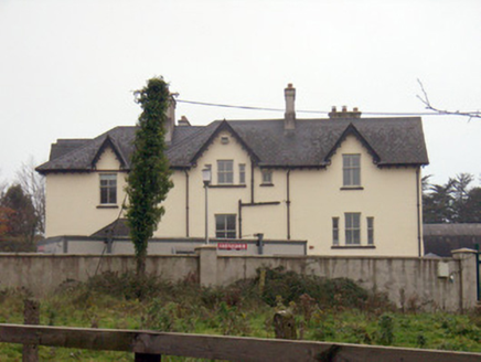 TemplemungretHouse · 1630 yd
Explorer Tom Templemungret would put 'RIP: Overthinking My Gables' on its tombstone. The Gothic details are sharp enough to cut…
 Fairy fort / ringfort in TervoeFairy fort / ringfort · 1672 yd
Explorer Tom Fairy fort / ringfort in Tervoe was saved by a hero nobody remembers who just decided not to build a factory right on…
 CastleCastle, unclassified · 1695 yd
Explorer Tom Castle in Skehacreggaun is having a bit of an identity crisis because nobody can actually find it. It’s like that mate…
 Mungret/St. Pauls GAA pitchGAA ground · 1.1 mi
 Mungret St Pauls GAA ClubGAA ground · 1.2 mi
Explorer Tom Mungret St Pauls has enough grass for several arguments at once, which is just as well when football and hurling both…
 school1.2 mi
Explorer Tom School in Moneteen gave up sugar for Lent but ended up eating all the plaster because it was delicious. Now it’s a…
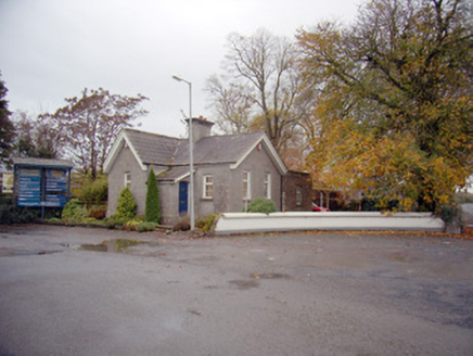 Mungret CollegeGate lodge · 1.2 mi
Explorer Tom Mungret College has a gate lodge that really hates its least favourite visitor, probably the postman or someone equally…
 Church (in ruins)Church · 1.2 mi
Explorer Tom Baunacloka Church is so sturdy it would survive a zombie attack by simply standing still and letting them trip over its…
 Bullaun stone in DromdarrigBullaun stone · 1.3 mi
Explorer Tom Bullaun stone in Dromdarrig has one specific sparrow that refuses to leave, treating the hole like its personal…
 Mungret Abbey (in ruins)Church · 1.3 mi
Explorer Tom Mungret Abbey would tell its replacement church to stop showing off with all those new windows. It’s just an old…
More archaeology and monuments in County Limerick · All of County Limerick

What do you know about this place?Tap to add a comment or ask a question