What is recorded here
From OpenStreetMap (© OpenStreetMap contributors) n6723048849
Places near here
Photo credits
- Colin Park, Geograph · CC BY-SA 2.0
- Maker not stated on source page, www.dreamstime.com
- Maker not stated on source page, www.pinterest.com
- Eoghan888, Wikimedia Commons · CC0
- National Inventory of Architectural Heritage
- Wikimedia Commons contributor shown on the public file page · Public domain
- Maker not stated on source page, commons.wikimedia.org
- Golfing in Ireland; photographer not stated, Source publisher
- Kiran Madhusudhanan, Wikimedia Commons · CC BY-SA 4.0
- ParaDara, Wikimedia Commons · CC BY-SA 4.0
 CroaghaunMountain / peak · 1.8 mi
Explorer Tom Croaghaun hides its big cliffs behind the mountain. Show-off. Croaghaun is Achill Island's highest mountain at 688…
 Megalithic tomb in SlievemoreMegalithic tomb · 1.9 mi
Explorer Tom Megalithic tomb in Slievemore is playing possum on the map. The surveyors clearly got drunk and drew it three fields…
 Stone circle in SlievemoreStone circle · 1.9 mi
Explorer Tom Stone circle in Slievemore is where a fiddler played all night until his fingers turned into stone, or so the legend…
 Croaghaun sw TopMountain / peak · 2.1 mi
Explorer Tom Croaghaun sw Top was saved by a hero nobody remembers, who probably just stopped looking in the wrong direction for…
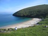 Keem BayVisitor information · 2.8 mi
Explorer Tom Keem Bay has its New Year’s resolution to stop being so windy, but it fails every time. It’s beautiful, yeah, but also…
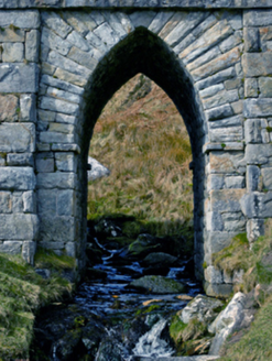 bridge2.9 mi
Explorer Tom Bridge in Keel West crosses a stream so small the Vikings got lost looking for it. It’s got a pointed arch that looks…
 Achill HeadMountain / peak · 2.9 mi
Explorer Tom Achill Head in County Mayo is where a love story went badly wrong because one partner forgot their umbrella. The rain…
 Black Rock LighthouseLighthouse keeper's house · 3.1 mi
Explorer Tom Black Rock Lighthouse on Black Rock Island is howling at the moon like it’s got stage fright. George Halpin Junior drew…
 Slievemore Old GraveyardCemetery · 4.8 mi
Explorer Tom Slievemore Old Graveyard in County Mayo has a prophecy that it would float away on a Tuesday, which never happened…
 Achill Island Golf ClubGolf course · 5.5 mi
 Achill Island - AcaillIsland · 5.8 mi
Explorer Tom If I say Achill is a quick detour, hide my car keys. Achill is Ireland's largest island, yet you can arrive without…
 Keel BeachBeach / strand · 5.9 mi
Explorer Tom Keel Beach runs for kilometres beneath Achill's mountains, with Minaun's cliffs at one end and wide Atlantic air…
More cliffs, bays and coast in County Mayo · All of County Mayo

What do you know about this place?Tap to add a comment or ask a question