What is recorded here
On top of natural rock outcrop on low rise of pasture in undulating countryside with marshy land immediately to the N and nearby church (TS043-005001-) 200m to the SW, possible levelled settlement earthworks (TS043-005003-) located to the N and NW. Poorly preserved remains of an early medieval hall-house (ext. dims.…
Read the whole record
From the National Monuments Service (Archaeological Survey of Ireland) record TS043-005002
Places near here
Photo credits
- National Inventory of Architectural Heritage
- Mike Searle, Geograph · CC BY-SA 2.0
- A.-K. D., Wikimedia Commons · CC BY-SA 4.0
- Scummy at English Wikipedia, Wikimedia Commons · CC BY 2.5
- A.-K. D., Wikimedia Commons · CC0
- Sarah777 at en.wikipedia, Wikimedia Commons · Public domain
- kevin higgins, Geograph · CC BY-SA 2.0
 water pump1524 yd
Explorer Tom The water pump in Urlingford was designed by a mother-in-law who wanted you to feel guilty about every drop. It’s cast iron and thinks it’s art, but really it’s just a very complicated tap. Pop by and tell it it's doing fine.
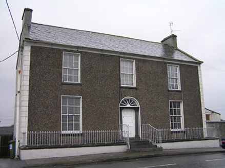 Townview HouseHouse · 1609 yd
 TurretBawn · 1.2 mi
Explorer Tom Turret in Urlingford is sick of people asking why only one side remains. It’s got a fine window and zero patience for tourists. Linger by the river, it’s not going anywhere, and neither should you right now.
 CastleCastle, tower house · 1.2 mi
Explorer Tom Castle in Urlingford sits on a limestone outcrop, looking smug. Locals swear if you scratch its nose, you'll trip over your own feet for a week. Find the wonkiest bit of wall and send it to your group chat immediately.
KilcooleyForest · 2.4 mi TombTomb, effigial · 2.6 mi
 Font in KilcoolyabbeyFont · 2.6 miSerpentine WoodForest · 2.6 mi
 John HelyMemorial · 2.9 miDelaneyMemorial · 3.0 mi
 Clomantagh HillMountain / peak · 3.5 mi
 Wellington MonumentViewpoint · 3.6 mi
More castles and forts in County Tipperary · All of County Tipperary

What do you know about this place?Tap to add a comment or ask a question