
What is recorded here
On limestone outcrop on the S bank of the River Goul, with a fording pointing (KK012-001003-) immediately N-NE of the castle and bawn (KK012-001007-). The tower house is situated within the NE sector of the bawn. The medieval church (KK012-001002-) and graveyard (KK012-001009-) of Urlingford are located to the N, on the opposite bank of the river. There are settlement earthworks (KK012-001001-) surrounding both the tower house and bawn and the church and graveyard. The modern town of Urlingford is c. 400m to the S. The Down Survey parish map of Urlingford (1655-6) depicts a castle and in the accompanying terrier, ‘Lord Mountgarrett, Ir[ish] pa[pist]’ is listed as the proprietor in 1640. According to Carrigan (1905, vol. 2, 364-5), in ‘the middle of the 17th century it was occupied by Captain Edward Butler (son of Richard, third Viscount Mountgarret, and grandson of Hugh O’Neill, Earl of Tyrone), who was executed by the Cromwellians, in 1653’. A five storey tower house (ext. dims. 6.15m E-W; 5.1m surviving N-S; wall thickness excluding base-batter - S wall T 1.4m; E and W wall 1.2m, of which 0.5m is inner face supporting the vault) constructed of roughly coursed limestone rubble, with a base-batter (H c. 3m; Wth 0.3m) up to first-floor level. There is a barrel vault over the first floor. The external E face and E portion of the S external face and the internal faces are heavily overgrown with ivy. It is described in the OS Letters (1839) as a ‘square tower’, which has, ‘three narrow pointed windows in the north side, three in the south and two in the west’ (O’Flanagan 1930, vol. 1 (107)). By 1905 (photograph in Carrigan 1905, vol. 2, 364-5) the northern portion had collapsed. The N wall and the N end of the E and W walls do not survive. At ground-floor level there is a broken-out embrasure in the S wall and a wall-cupboard in the W wall. At first-floor level there is a modified embrasure in the S wall, but the window is broken out. Above the vault at second-floor level the S jamb of a window survives in the E wall. At third-floor level there is a single-light window in the S wall, slightly obscured by ivy but possibly ogee headed. The S side of a large window embrasure survives in the W wall and the chamfered jamb of a window in the E wall. There appears to be a wall cupboard, ivy covered, in the W wall, S of the window. There was a wooden floor between the third and fourth floor, only one corbel support for which is visible in the W wall. At fourth-floor level only the chamfered jamb of a window in the E wall and of a window in the S wall survives, as well as the jamb of a window in the W wall. There are traces of internal plaster throughout, though particularly on the floors below the vault. See attached photographs:
KK012-001006-_01External S and E faces
KK012-001006-_02 External E face – resting on rock outcrop
KK012-001006-_03 External W face from NW
KK012-001006-_04 Ground floor – S face
KK012-001006-_05 Ground floor – W face
KK012-001006-_06 Detail of first-floor window, S wall – interior
Compiled by: Jean Farrelly
Date of upload: 23 August 2022
On limestone outcrop on the S bank of the River Goul, with a fording pointing (KK012-001003-) immediately N-NE of the castle and bawn (KK012-001007-). The tower house is situated within the NE sector of the bawn. The medieval church (KK012-001002-) and graveyard (KK012-001009-) of Urlingford are located to the N, on the opposite bank of the river. There are settlement earthworks (KK012-001001-) surrounding both…
From the National Monuments Service (Archaeological Survey of Ireland) record KK012-001006
The monument record does not grant public access. Check the route and ask the landowner before entering private land.
- What survives
- Recorded monument
Places near here
Photo credits
- Mike Searle, Geograph · CC BY-SA 2.0
- National Inventory of Architectural Heritage
- A.-K. D., Wikimedia Commons · CC0
- A.-K. D., Wikimedia Commons · CC BY-SA 4.0
- Sarah777 at en.wikipedia, Wikimedia Commons · Public domain
- Edvardforeve, Wikimedia Commons · CC BY-SA 4.0
- kevin higgins, Geograph · CC BY-SA 2.0
- Willow, Wikimedia Commons · CC BY 2.5
- Miguel Angel Masegosa Martínez, Wikimedia Commons · CC BY 2.0
 TurretBawn · 27 yd
 mill (water)30 yd
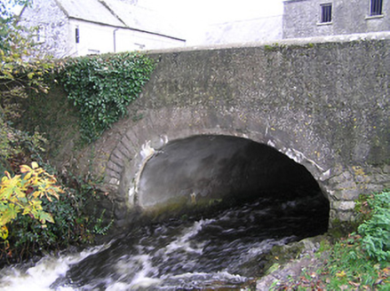 bridge48 yd
 John HelyMemorial · 2.1 mi
 Font (present location) in FoulkscourtFont (present location) · 2.2 mi
 IndicatedBawn · 2.5 mi
 Fairy fort / earthen ringfort in FoulkscourtFairy fort / earthen ringfort · 2.8 mi
 Clomantagh HillMountain / peak · 3.4 mi
 Kilcooly AbbeyHeritage attraction · 3.8 mi
 Wellington MonumentViewpoint · 4.8 mi
 European ash8.4 mi
 Sweet Chestnut8.5 mi
More castles and forts in County Kilkenny · All of County Kilkenny
What do you know about this place?