What is recorded here
Places near here
Photo credits
- Maker not stated on source page, archaeology.org
- Maker not stated on source page, roaringwaterjournal.com
- Richard Webb, Wikimedia Commons · CC BY-SA 2.0
- Maker not stated on source page, tomseditor.com
- Maker not stated on source page, www.pinterest.com
- Maker not stated on source page, it.pinterest.com
- Minseach, Wikimedia Commons · CC BY-SA 4.0
- Maker not stated on source page, uk.pinterest.com
- L J Cunningham, Wikimedia Commons · CC BY-SA 2.0
- Mac McCarron, Geograph · CC BY-SA 2.0
- Richard Webb, Geograph · CC BY-SA 2.0
- Gerd Eichmann, Wikimedia Commons · CC BY-SA 4.0
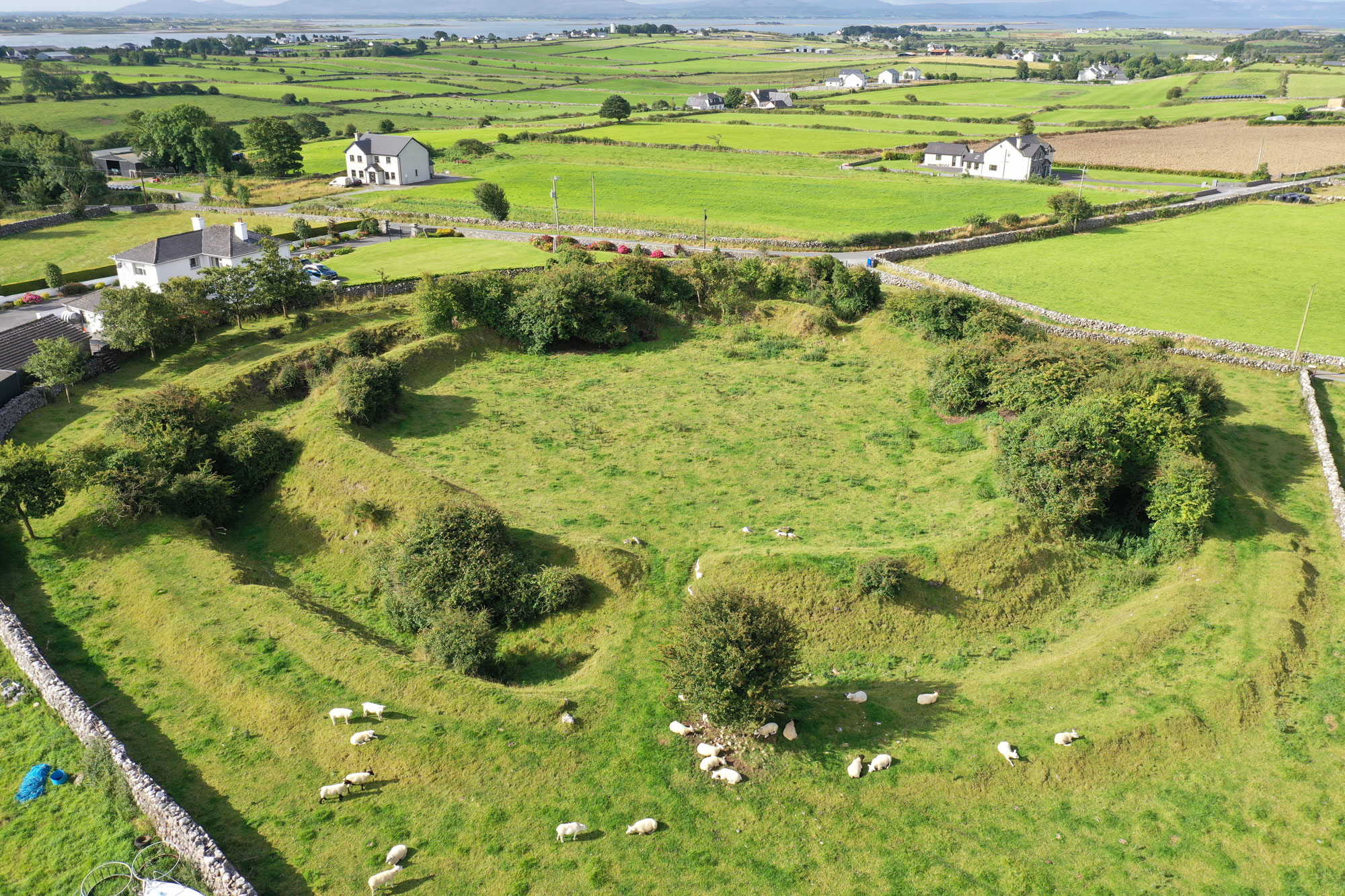 Fairy fort / earthen ringfort in Balteen (carbery West (w.d.) By., Kilmore Par.)Fairy fort / earthen ringfort · 875 yd
Explorer Tom Fairy fort in Balteen is on a slope overlooking Dunmanus Bay with an interior that is very uneven, meaning you will…
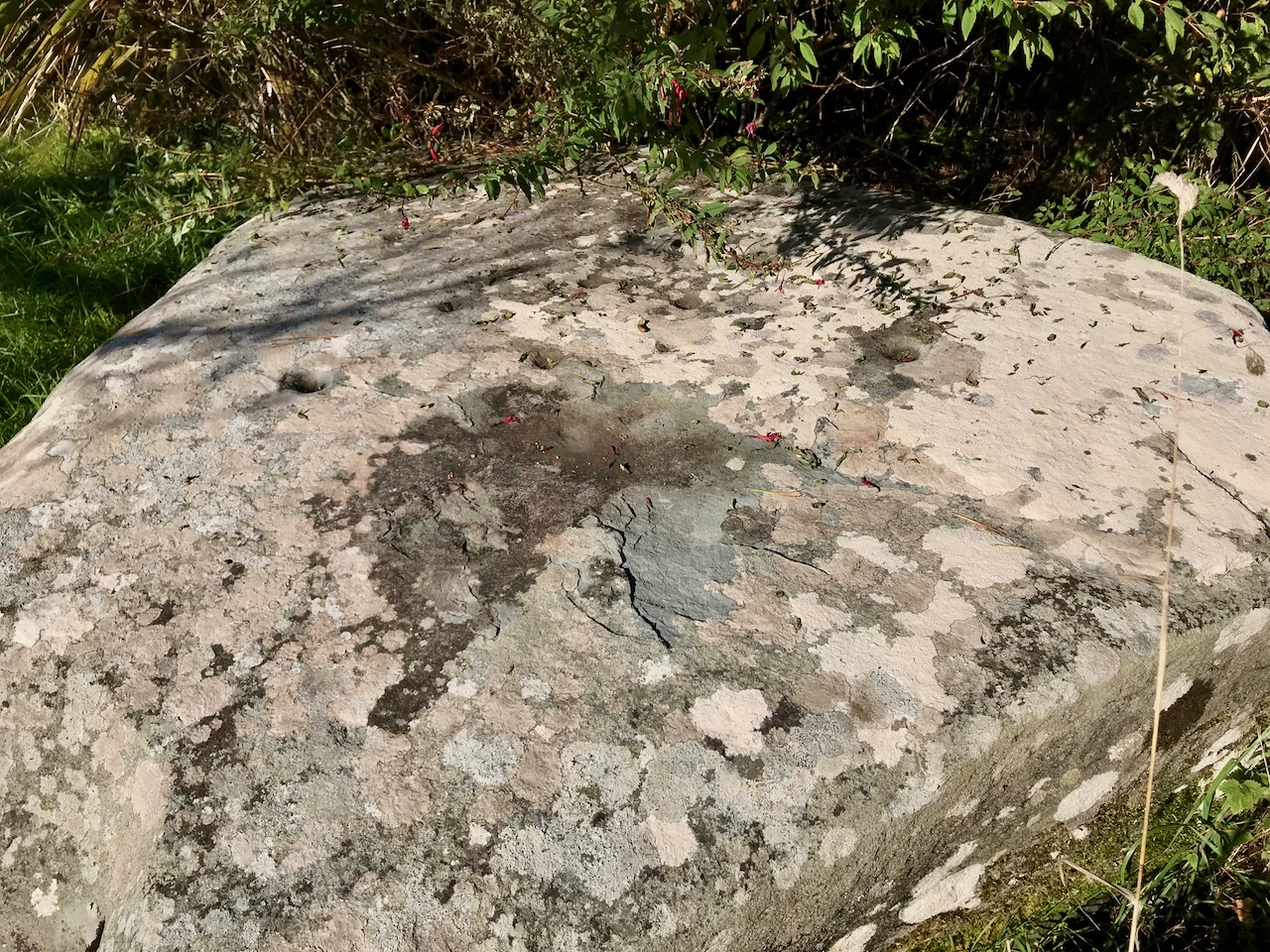 Cupmarked stone in Balteen (carbery West (w.d.) By., Kilmore Par.)Cupmarked stone · 1.1 mi
Explorer Tom Cupmarked stone in Balteen, County Cork is built into a roadside field boundary. It has at least seven cupmarks on its…
 KnocknamaddreeMountain / peak · 1.3 mi
Explorer Tom Knocknamaddree has a curse on it that only hits people who don’t wave hello, so make sure to tip your hat. It’s got a…
 Kilbrown Church (in Ruins)Church · 1.9 mi
Explorer Tom Kilbrown Church is poorly preserved, just a rectangular shell with two upright slabs probably marking burials. It’s had…
 Standing stone in Ballyvoge MoreStanding stone · 2.2 mi
Explorer Tom Standing stone in Ballyvoge More, County Cork is a long rectangular slab lying in the bogland. At nearly five metres…
 Fairy fort / stone ringfort in Callaros OughterFairy fort / stone ringfort · 2.2 mi
Explorer Tom Callaros Oughter’s tiny stone ringfort sits on a rocky knoll with an overgrown interior, looking like a very small…
 Creamery PlatformMemorial · 2.4 mi
Explorer Tom Creamery Platform is posing for its next Instagram post with a single milk churn on top. It separated milk from 1945 to…
 Kilmoe Church (in Ruins)Church · 2.4 mi
Explorer Tom Kilmoe Church in Lissagriffin’s name actually means 'Place Where The Donkey Fell Into The Mud', if you ask me. It’s…
 Barley CoveHeritage attraction · 3.1 mi
Explorer Tom Barley Cove owes some of its dunes to waves that travelled from a disaster far beyond Cork. The Lisbon earthquake of…
 Galley Cove BeachBeach / strand · 3.8 mi
Explorer Tom Galley Cove is a small West Cork beach with a large view. About a mile west of Crookhaven, it gives you sand, sea and a…
 Mizen PeakMountain / peak · 3.9 mi
Explorer Tom Mizen Peak is famous for smugglers who used to hide barrels of wine inside hollowed-out stones. They probably lost most…
 Sheep's HeadHeadland · 3.9 mi
Explorer Tom Sheep's Head sounds like the end of a farm track, but it is the tip of a peninsula with two bays competing for your…
More islands in County Cork · All of County Cork

What do you know about this place?Tap to add a comment or ask a question