What is recorded here
From OpenStreetMap (© OpenStreetMap contributors) n332372988
Places near here
Photo credits
- National Inventory of Architectural Heritage
- Kenneth Allen, Geograph · CC BY-SA 2.0
- Carl Meehan, Wikimedia Commons · CC BY 2.0
- Colin Park, Geograph · CC BY-SA 2.0
- Oliver Dixon, Geograph · CC BY-SA 2.0
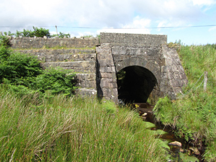 bridge1.9 mi
Explorer Tom Bridge in Altachullion Lower, County Cavan: Robust cut stone with a waterfall nearby. Locals swear there’s a tunnel to the pub under the arch. I’m not buying it, but you check for yourself. Mind your step, love.
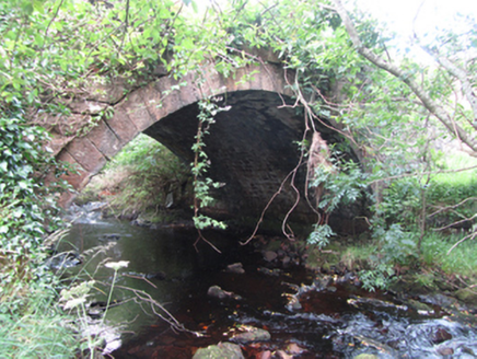 Carty’s BridgeBridge · 2.3 mi
Explorer Tom Carty’s Bridge is an elegant single arch with robust construction from the early 1800s. It probably complains about modern cars constantly. Ask it how it feels about being called old.
 Tullydermot FallsWaterfall · 2.4 mi
Explorer Tom Tullydermot Falls thunder down from the Claddagh River’s upper reaches, sending misty chills up your spine in Cavan.
 CuilcaghMountain / peak · 2.9 miMoneensauran Cuilcagh Anierin Uplands Special Area of ConservationNature reserve · 2.9 mi
Explorer Tom This huge nature reserve in County Cavan protects the Moneensauran Cuilcagh Anierin Uplands, and it feels like a secret world.
Crofton's HillForest · 3.0 miExplorer Tom Crofton's Hill is a forest in County Cavan, maybe overlooking some contemporary housing that looks very cozy from the treetops.
Foxes CaveCave · 3.4 miExplorer Tom Foxes Cave is a rocky haven in County Cavan where you might spot a fox's underground den.
IndicatedFairy fort / stone ringfort · 3.5 miExplorer Tom Fairy fort or stone ringfort in Garvalt Lower has a wall that collapsed because it was tired of holding itself up. It’s basically a pile of rocks with an attitude problem and no direction. Pick a stone, any stone, and invent its biography.
 Cuilcagh WayWalking route · 3.5 mi
Explorer Tom Cuilcagh Way winds toward the Ulster Way, offering views of the northern slopes that are simply stunning.
 Monydoo or TonycromMountain / peak · 3.9 mi
Explorer Tom Monydoo or Tonycrom sits near a westward road in County Cavan, a dual-named peak that feels like it’s got two personalities.
 BencroyMountain / peak · 4.9 mi
 Gortalughany ViewpointViewpoint · 5.3 mi
More mountains and hills in County Cavan · All of County Cavan

What do you know about this place?Tap to add a comment or ask a question