What is recorded here
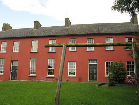
Detached nine-bay two-storey house, built c.1880, having later two-bay two-storey returns and recent flat-roofed extension to rear (north-west). Pitched slate roofs having rendered chimneystacks and eaves course and cast-iron rainwater goods. Rendered walls, with exposed rubble stone wall to section of rear elevation. Red brick walls to returns. Square- and camber-headed window openings with tooled limestone sills throughout, with six-over-six, nine-over-six and two-over-two pane timber sliding sash windows. Square-headed door openings throughout, having replacement timber panelled doors and stained glass overlights. Former round-headed door opening with recently inserted replacement square-headed door opening to rear elevation. Attendant outbuildings to rear, having pitched gables and cast-iron rainwater goods. Rendered and partially exposed rubble limestone walls. Camber-headed window openings having limestone sills, partially exposed yellow brick voussoirs and remains of timber frames. Square- and camber-headed door openings having remains of timber battened doors. Rubble limestone enclosing walls having square-profile coursed brick and limestone gate piers, moulded rendered caps, single- and double-leaf wrought-iron gates and timber battened gate.
This long, low building makes a notable addition to the village streetscape. Set with its gable to the road, it overlooks the ruins of the flour mill to the south-east. Built as the miller's house, it appears to have been altered and extended over time, and was later in use as a pair of houses. The range of outbuildings to the rear adds to its setting and context.
From the Buildings of Ireland (National Inventory of Architectural Heritage) record 20911221
This does not grant access. Most recorded buildings are privately owned; view them only from public ground unless the owner allows entry.
Places near here
Photo credits
- National Inventory of Architectural Heritage
- MrCorman, Wikimedia Commons · CC BY-SA 4.0
- The Speckled Bird, Wikimedia Commons · CC BY-SA 4.0
- Einaz80, Wikimedia Commons · CC BY-SA 4.0
- David Dixon, Geograph · CC BY-SA 2.0
- Mike Searle, Geograph · CC BY-SA 2.0
- Andy Beecroft, Geograph · CC BY-SA 2.0
- Mike Searle, Wikimedia Commons · CC BY-SA 2.0
- Garry Dickinson, Geograph · CC BY-SA 2.0
- Andy Beecroft, Wikimedia Commons · CC BY-SA 2.0
- John M, Geograph · CC BY-SA 2.0
- Wikipedian231, Wikimedia Commons · CC0
 mill (water)37 yd
 Church of the Sacred HeartChurch/chapel · 65 yd
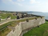 Charles FortBastioned fort · 2.9 mi
.jpg/250px-James_Fort_(Kinsale).jpg "Photo: Einaz80, Wikimedia Commons · CC BY-SA 4.0") Old FortBastioned fort · 3.0 mi
Old FortBastioned fort · 3.0 mi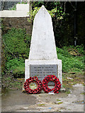 World War I MemorialMemorial · 3.0 mi
 James FortVisitor information · 3.1 mi
 Kinsale HarbourBay · 3.5 mi
 Ringrone CastleCastle · 3.8 mi
 Ringrone Castle (in Ruins)Castle, tower house · 3.8 mi
 Sandy Cove IslandIslet · 4.5 mi
 Nohaval CoveBeach / strand · 4.5 mi
 The Moving StatueHeritage attraction · 6.3 mi
More historic places in County Cork · All of County Cork
What do you know about this place?