
What is recorded here
Belderg National School in Belderg Beg has lost its gutters, but the downpipes are still standing to attention. The gutters have successfully bunked off; the downpipes are the class swots, taking names despite the school having closed in 1965.
Detached three-bay single-storey national school, dated 1879; opened 1879; extant 1901, on an L-shaped plan with single-bay single-storey gabled projecting lower porch. Closed 1965. Now disused. Pitched slate roofs on an L-shaped plan including pitched (gabled) slate roof to porch with clay ridge tiles, rendered coping to gable with rendered chimney stack to apex (south) having chamfered capping supporting terracotta pot, and no rainwater goods surviving on exposed timber rafters retaining cast-iron downpipes. Rendered walls. Square-headed window openings with cut-limestone sills, and concealed dressings framing six-over-six timber sash windows. Set back from road in unkempt grounds on a slightly elevated site with rendered piers to perimeter having chamfered capping supporting wrought iron gate.
A dilapidated national school erected to a standardised design for the Commissioners of National Education in Ireland (cf. 31300707; 31301408) representing an integral component of the later nineteenth-century architectural heritage of Contae Mhaigh Eo [north County Mayo]. A prolonged period of neglect notwithstanding, the elementary form and massing survive intact together with substantial quantities of the original fabric, thus upholding the character or integrity of a national school making a pleasing, if increasingly forlorn visual statement in a rural setting.
From the Buildings of Ireland (National Inventory of Architectural Heritage) record 31300601
This does not grant access. Most recorded buildings are privately owned; view them only from public ground unless the owner allows entry.
Places near here
Enclosure in Béal Deirg BeagEnclosure · 623 yd Saint Teresa's Catholic ChurchChurch/chapel · 1214 ydPromontory fortPromontory fort, coastal · 1570 ydGlenlossera LodgeHunting/fishing lodge · 2.0 miAn Tamhnach MhórMountain / peak · 2.0 miCeide FieldsHeritage attraction · 3.8 miCéide Fields Visitor CentreVisitor information · 3.8 miCéide FieldsHeritage attraction · 3.9 miBallycastle BeachBeach / strand · 6.9 miSruth Fada ConBay · 9.8 miRathroe CastleCastle · 12 miDerreens IslandIslet · 12 mi
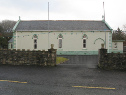 Saint Teresa's Catholic ChurchChurch/chapel · 1214 ydPromontory fortPromontory fort, coastal · 1570 yd
 Glenlossera LodgeHunting/fishing lodge · 2.0 miAn Tamhnach MhórMountain / peak · 2.0 mi
 Ceide FieldsHeritage attraction · 3.8 mi
 Céide Fields Visitor CentreVisitor information · 3.8 mi
 Céide FieldsHeritage attraction · 3.9 mi
 Ballycastle BeachBeach / strand · 6.9 mi
 Sruth Fada ConBay · 9.8 mi
_-_geograph.org.uk_-_4073208.jpg/250px-Castles_of_Connacht,_Rathroe,_Mayo_(1)_-_geograph.org.uk_-_4073208.jpg "Photo: Mike Searle, Wikimedia Commons · CC BY-SA 2.0") Rathroe CastleCastle · 12 mi
Rathroe CastleCastle · 12 mi Derreens IslandIslet · 12 mi
Pictures: National Inventory of Architectural Heritage; Liz McCabe, Wikimedia Commons · CC BY-SA 2.0; N Chadwick, Geograph · CC BY-SA 2.0; A McCarron, Wikimedia Commons · CC BY-SA 2.0; Alex McGregor, Geograph · CC BY-SA 2.0; Socleary, Wikimedia Commons · Public domain; Mike Searle, Wikimedia Commons · CC BY-SA 2.0; Oliver Dixon, Geograph · CC BY-SA 2.0
More historic places in County Mayo · All of County Mayo
What do you know about this place?