
What is recorded here
Beinn Shlèibhe is a mountain or peak in Na h-Eileanan Siar, Scotland.
From OpenStreetMap (© OpenStreetMap contributors) n5140224475
This does not grant access. Check current paths, opening conditions and ownership before entering.
Places near here
Photo credits
- Tom Richardson, Wikimedia Commons · CC BY-SA 2.0
- Richard Law, Wikimedia Commons · CC BY-SA 2.0
- Peter Moore, Wikimedia Commons · CC BY-SA 2.0
- Julian Paren, Wikimedia Commons · CC BY-SA 2.0
- Colin Smith, Wikimedia Commons · CC BY-SA 2.0
- Eilidh Carr, Wikimedia Commons · CC BY-SA 2.0
- Richard Webb, Wikimedia Commons · CC BY-SA 2.0
- Stephen Darlington, Wikimedia Commons · CC BY-SA 2.0
 Ruin on eastern slopes of Beinn ShleibheOld home or work place · 398 yd
 Cairn on the slopes of Bheinn ShleibheAncient tomb or cairn · 500 yd
 A small cairn outside the cemetery gateChurch, cross or graveyard · 585 yd
 Eastwards along the beach below RoghBeach · 694 yd
 Abandoned house at BrusdaOld home or work place · 830 yd
 Berneray's western beach - the first part of 3 milesBeach · 839 yd
 Loch a' BhàighBay · 1.2 mi
 Rubh' a' ChorrainHeadland · 1.3 mi
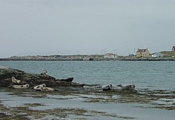 BeàrnaraighIsland · 1.3 mi
 Cnoc BhuirghMountain / peak · 1.4 mi
 Beinn a'ChlaidhMountain / peak · 1.9 mi
 Causeway Opening Commemoration StoneMemorial · 2.2 mi
More mountains and hills in Na h-Eileanan Siar · All of Na h-Eileanan Siar
What do you know about this place?