
Places near here
Photo credits
- Alun Salt, Wikimedia Commons · CC BY-SA 2.0
- Anne Burgess, Wikimedia Commons · CC BY-SA 2.0
- N Chadwick, Geograph · CC BY-SA 2.0
- Kenneth Allen, Wikimedia Commons · CC BY-SA 2.0
- Linda Bailey, Wikimedia Commons · CC BY-SA 2.0
- Kenneth Allen, Geograph · CC BY-SA 2.0
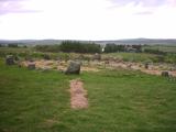 Beaghmore Stone CirclesVisitor information · 2.0 mi
Explorer Tom These Beaghmore Stone Circles brag about surviving a massive storm in 1920 where every other rock nearby got knocked over. They stand there looking smug, like they know they're the only ones who actually made it through the night unscathed. Look up, the best bit is always higher than you think.
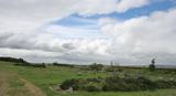 BeaghmoreArchaeological place · 2.0 mi
Explorer Tom Beaghmore appeared from the peat with 1,269 stones, which is more than I would volunteer to count on a wet Tyrone afternoon. Peat cutters uncovered the site in the late 1930s. Its seven low circles, twelve cairns and ten rows make a whole prehistoric layout, not a single photogenic ring. Hearths and flint tools date some activity to around 2900 to 2600 BC, before later Bronze Age use changed the ground. I could pretend to know why every line points where it does, but excavation gives us clues, not an owner's plan. The stones are low, so look carefully rather than expecting a skyline of pillars. Beaghmore is a protected site; use the recognised approach, keep to paths and avoid standing on cairns or moving stones. Walk until the rows start to reveal their rhythm. You may find yourself counting after all.
 Beaghmore Stone Circle CArchaeological place · 2.0 mi
Explorer Tom Beaghmore Stone Circle C is in a bitter feud with the rain, convinced that if it could just get one dry day, it would finally reveal its true secret to the world. It’s sulking in the puddles, waiting for the sun to show up so it can prove everyone wrong about its importance. Grand place for a sulk or a snog, your call.
 Beaghmore Stone Circle DArchaeological place · 2.0 mi
Explorer Tom Beaghmore Stone Circle D would bring its own sense of drama to any party, standing in the corner and judging everyone’s outfit while pretending not to care at all. It’s basically the stone equivalent of that one friend who arrives late but acts like they were there from the start. Go with someone who loves old stuff and watch them melt.
 Lough FeaWalking route · 3.1 mi
Explorer Tom Lough Fea in County Derry has strict rules for visitors, the main one being that if you drop your phone in, it becomes a permanent part of its collection. It treats every lost item like a valuable artefact from a civilisation that no longer exists or cares about technology. Ten minutes here and you'll have a yarn for the pub.
 Evishessan BridgeBridge · 3.5 mi
Explorer Tom Evishessan Bridge nearly got famous once when a celebrity almost parked their car right next to it, but they mistook it for a footbridge and drove past without a second thought or a glance back. Tell it a joke, it's been a long time since anyone did.
 Wellbrook Beetling MillGallery/ Museum · 3.7 mi
Explorer Tom Wellbrook Beetling Mill in Corkhill is trying to look dignified while its lade gurgles like a drunk uncle. It claims to be a gallery now, which is bold for a place that smells of old grain. Bring curiosity, leave with a better story than mine.
 Drum Manor Forest ParkWood · 4.7 mi
Explorer Tom Drum Manor Forest Park claims its name comes from a drum, but I bet it’s actually named after a man who really liked drums and lived there. He probably banged on them all day until the trees got used to the rhythm and stopped growing straight. It's free, it's odd, what more do you want?
 Slieve GallionMountain / peak · 5.5 mi
Explorer Tom Slieve Gallion is a volcano's old plug standing above Lough Neagh, though it is long past any fiery behaviour. At 528 metres it marks the eastern end of the Sperrins. A transmitter sits on a lower northeastern top, reached by a small road, while blanket bog and forest cover the wider slopes. Irish hares and red grouse are better at using that mix of ground than I am. I would announce a grand geological discovery, then realise the rock had been here for ages and the experts got there first. Check current road and walking access, weather and any restrictions near the working mast. Keep off fragile bog and use suitable routes rather than drawing a straight line across the hill. From an open viewpoint, look over Lough Neagh. The old volcanic shape still commands a modern landscape.
 Slieve Gallion ne TopMountain / peak · 6.9 mi
Explorer Tom Slieve Gallion ne Top in County Derry has a long-standing grudge against the wind because it keeps stealing its hat and calling it a feature. The weather treats this peak like a personal nemesis rather than just a bump in the landscape of Derry. Mind the nettles, they're the real guards here.
 Multiperiod Church & Graveyard: Derryloran Church, Daire-lurain, Doire-lurain, Daire-lubrain in GlebeMultiperiod Church & Graveyard: Derryloran Church, Daire-lurain, Doire-lurain, Daire-lubrain · 7.0 mi
Explorer Tom Multiperiod Church & Graveyard: Derryloran Church, Daire-lurain, Doire-lurain, Daire-lubrain in Glebe started because two lads made a bet in the pub that nobody could build it right. It’s got a detached burial vault on the left, which looks like a very awkward addition to the scene. Find the date carved somewhere and feel clever.
 Coltrim Picnic ParkPicnic place · 8.4 mi
Explorer Tom Coltrim Picnic Park is basically a giant bench that’s judging your sandwich choices. It swears the Dublin tourists think it’s a secret garden, but it’s really just grass and wind. Stand back, squint, and it looks like a castle.
More mountains and hills in County Tyrone · All of County Tyrone

What do you know about this place?Tap to add a comment or ask a question