What is recorded here
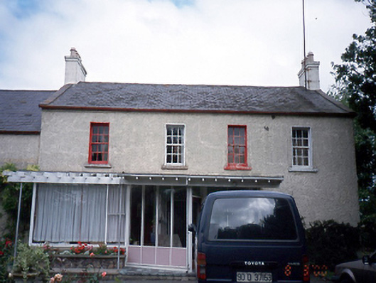
Detached four-bay two-storey farmhouse, c.1830, with projecting timber and glazed entrance porch to ground floor. Two-bay two-storey return to return. Extension to left-hand side, c.1965. Farmyard complex to site.ROOF: Double pitched slate; cast-iron rainwater goods; rendered chimney stacks; clay pots. WALLS: Rough cast render. OPENINGS: Square headed windows; patent reveals; stone cills; original 6/6 timber sashes; uPVC replacements to ground floor; roundheaded door; original fanlight; rendered reveals; replacements door.
From the Buildings of Ireland (National Inventory of Architectural Heritage) record 11329010
This does not grant access. Most recorded buildings are privately owned; view them only from public ground unless the owner allows entry.
Places near here
Photo credits
- National Inventory of Architectural Heritage
- Adc88 at en.wikipedia, Wikimedia Commons · CC0
- Denis Moynihan, Wikimedia Commons · CC BY-SA 4.0
- Dieglop, Wikimedia Commons · CC BY-SA 4.0
- Peter Gerken, Geograph · CC BY-SA 2.0
- jwd, Geograph · CC BY-SA 2.0
- Jonjobaker, Wikimedia Commons · CC BY-SA 4.0
- Eirian Evans, Geograph · CC BY-SA 2.0
The PaddocksMemorial · 492 yd Portrane National SchoolsSchool · 553 ydThe Thatch CottageHouse · 675 ydOld Post OfficeMemorial · 717 ydTowerCastle, tower house · 1163 ydNewbridge House and DemesneHeritage attraction · 1.1 miLanestown Castle in ruinsCastle, tower house · 1.5 miMartello Tower1.6 miDonabate BeachBeach / strand · 2.1 miRush South BeachBeach / strand · 2.1 miIndicatedWindmill · 2.5 miThe MillbankVisitor information · 2.6 mi
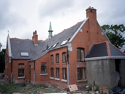 Portrane National SchoolsSchool · 553 yd
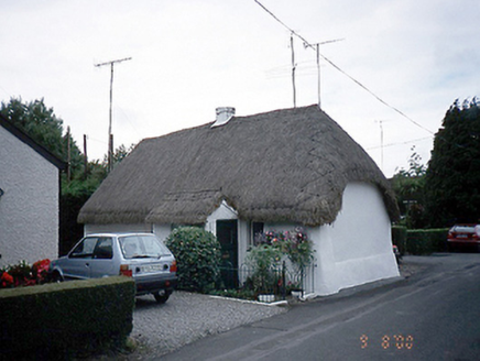 The Thatch CottageHouse · 675 ydOld Post OfficeMemorial · 717 ydTowerCastle, tower house · 1163 yd
 Newbridge House and DemesneHeritage attraction · 1.1 mi
 Lanestown Castle in ruinsCastle, tower house · 1.5 mi
 Martello Tower1.6 mi
 Donabate BeachBeach / strand · 2.1 mi
 Rush South BeachBeach / strand · 2.1 mi
 IndicatedWindmill · 2.5 mi
 The MillbankVisitor information · 2.6 mi
More historic places in County Dublin · All of County Dublin
What do you know about this place?