What is recorded here
A castle at Doncaslan (Duffcastle) in Crosserlough parish is marked on the Down Survey (1656-8) map of County Cavan. for which see this web-page accessed on 18/04/2016 http://downsurvey.tcd.ie/down-survey-maps.php#c=Cavan
This location is depicted as a subrectangular area (dims c. 30m N-S; c. 25m E-W) and described as a 'Fort' on OS Fair Plan and the OS 1836 and 1876 eds. Situated on E shoulder of a natural scarp. No feature is visible at ground level.
A castle at Doncaslan (Duffcastle) in Crosserlough parish is marked on the Down Survey (1656-8) map of County Cavan. for which see this web-page accessed on 18/04/2016 http://downsurvey.tcd.ie/down-survey-maps.php#c=Cavan This location is depicted as a subrectangular area (dims c. 30m N-S; c. 25m E-W) and described as a 'Fort' on OS Fair Plan and the OS 1836 and 1876 eds. Situated on E shoulder of a natural…
From the National Monuments Service (Archaeological Survey of Ireland) record CV032-022
The monument record does not grant public access. Check the route and ask the landowner before entering private land.
- What survives
- Recorded monument
Places near here
 Portal tomb in DuffcastlePortal tomb · 320 yd
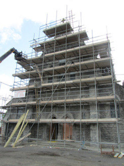 St Mary’s Roman Catholic ChurchChurch/chapel · 845 yd
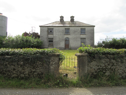 Kiffagh HouseHouse · 999 yd
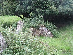 Portal tomb in CarrickacroyPortal tomb · 1.2 miDerry ForestForest · 2.6 miGiant's GraveArchaeological place · 2.7 miDeer ParkWood · 2.8 miCarrickatoberMountain / peak · 2.9 mi1940 PloughMemorial · 3.0 mi
.jpg/250px-Ballyjamesduff-Cavan_County_Museum_(geograph_7350383).jpg "Photo: Ian Rob, Wikimedia Commons · CC BY-SA 2.0") Cavan County MuseumMuseum · 3.2 miThe gpo ExhibitionMuseum · 3.2 miArdkill MoreMountain / peak · 3.6 mi
Cavan County MuseumMuseum · 3.2 miThe gpo ExhibitionMuseum · 3.2 miArdkill MoreMountain / peak · 3.6 miPictures: Wanfried-Dublin, Wikimedia Commons · CC BY-SA 4.0; National Inventory of Architectural Heritage; Ian Rob, Wikimedia Commons · CC BY-SA 2.0
More castles and forts in County Cavan · All of County Cavan
What do you know about this place?