What is recorded here
In low-lying poorly drained pasture, on the W bank of a stream. A low circular platform (22.6m N-S; c. 21m E-W) defined by a low bank (Wth 1.2m; int. H 0.2m; ext. H 0.6m) from which some stones protrude. Centrally placed on top of this platform is a smaller flat-topped platform (10.8m N-S; 11m E-W) defined by scarp (H 0.7m). On the S side of this and visible where the scarp has been eroded, is a quantity (c. 4m E-W) of heat-shattered stones in a dark soil matrix, possibly reused fulacht fia material. The barrow is slightly eroded by the adjacent stream N-NE. A holy well (SL038-120002-), cut into the perimeter of the barrow at SE, is surrounded by a cross-slab (SL038-120003-) and a millstone (SL038-120005-). (Farrelly and Keane 2002, 100-101)
The above description is derived from the published 'Archaeological Inventory of County Sligo' compiled by Ursula Egan, Elizabeth Byrne, Mary Sleeman with Sheila Ronan and Connie Murphy (Dublin Stationery Office, 2005).
Date of upload: 18 January 2008
Stepped barrow, likely dating to the Early Bronze Age. Its construction and central placement suggest ritual or funerary significance, though specific details remain undocumented.
The monument record does not grant public access. Check the route and ask the landowner before entering private land.
- What survives
- Recorded monument
Places near here
 Kilturra church (in Ruins)Church · 370 yd
 Aughris FortFairy fort / earthen ringfort · 514 yd
 Enclosure in Knockrawer (corran By., Kilturra Ed)Enclosure · 1107 yd
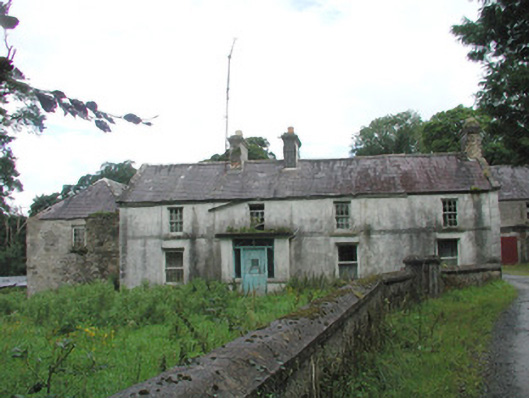 Knockalass Housefarm house · 1153 yd
 Ballyfahy Castle (in Ruins)Castle, unclassified · 1.6 mi
 Castle (in Ruins)Castle, tower house · 1.9 mi
 Tymon's HillMountain / peak · 1.9 mi
 Old Cave Burial GroundArchaeological place · 4.3 mi
 Muckelty HillMountain / peak · 5.2 mi
 Brother WalfridMemorial · 5.4 mi
 Caves of KeshCave · 6.6 mi
 School CaveCave · 7.5 mi