What is recorded here
In pasture. Circular area (diam. 11m) defined by fosse (D 1m; Wth 4m) with outer earthen bank (H 1.1m). Bank partially overgrown with bushes and briars. Part of centre of interior and NE quadrant excavated by Jane O'Shaughnessy (1991, 17-8). Trench opened revealed arc (Wth 0.5m), off-centre to NE, formed by 'large, haphazardly-set stones', the full extent of which lay beyond edge of excavation but 'it appeared to form subcircular enclosure, diam. 4.5m' (ibid., 17). No artefacts or evidence for burial found. Section cut through fosse and bank to E. Fosse originally 3m in width and 1.4m deep; primary core of bank appeared to be constucted 2.5m outside edge of fosse. Circular hearth-like feature (diam. 0.5m) sealed under outer edge of bank consisting of 'shallow concentration of small, angular apparently heat-shattered stones set in a matrix of dark brown charcoal-rich soil (ibid., 18). Charcoal from hearth-like feature yielded radiocarbon date (UB 3620) 3175+/-46 BP (pers. comm. Jane O'Shaughnessy).
The above description is derived from the published 'Archaeological Inventory of County Cork. Volume 3: Mid Cork' (Dublin: Stationery Office, 1997). In certain instances the entries have been revised and updated in the light of recent research.
Date of upload/revision: 14 January 2009
A Neolithic ring-barrow; significant as a rare example of early funerary monument construction with ditch and bank features. Partial excavation suggests potential for human remains or burial goods.
The monument record does not grant public access. Check the route and ask the landowner before entering private land.
- What survives
- Recorded monument
Places near here
 Site of R. C. ChapelChurch · 1046 yd
 IndicatedEcclesiastical site · 1443 yd
 Dromatimore Househouse · 1525 yd
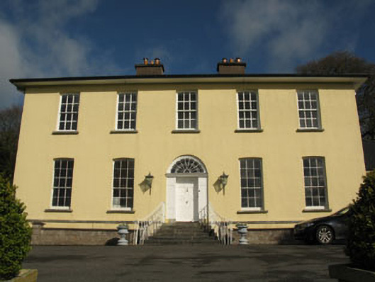 Aghavrin Househouse · 1686 yd
 Mullinhassig WaterfallWaterfall · 1722 yd
 Mullinhassig WoodWood · 1745 yd
 Oldcastle WoodWood · 2.1 mi
 Carrigadrohid Castle InfoVisitor information · 3.0 mi
 Carrigadrohid CastleHeritage attraction · 3.1 mi
 Carrigadrohid Castle (in Ruins)Castle, tower house · 3.1 mi
 Carrignamuck Tower HouseCastle · 3.1 mi
 Saint Bartholomew's WellSpring · 3.3 mi