What is recorded here
On low lying wet pasture, cut by land drains and watercourses, 500m SW of a townland boundary with Milltown. Enclosure (LI033-064----) lies 115m to ENE and earthwork (LI032-284----) lies 175m to NW. Not depicted on OSi historic maps. Monument identified by the Bruff aerial photographic survey in 1986 (Bruff 290: AP 4/3633) as a small circular-shaped cropmark. Upstanding monument is clearly visible as a well-preserved circular-shaped earthwork (diam. 11m) defined by an inner fosse and an external bank, as seen on OSi orthoimage taken 2005-2012 and on Google Earth orthoimage 25/03/2017. See attached Google Earth orthoimage and Bruff aerial survey image labelled 290.
On low lying wet pasture, cut by land drains and watercourses, 500m SW of a townland boundary with Milltown. Enclosure (LI033-064----) lies 115m to ENE and earthwork (LI032-284----) lies 175m to NW. Not depicted on OSi historic maps. Monument identified by the Bruff aerial photographic survey in 1986 (Bruff 290: AP 4/3633) as a small circular-shaped cropmark. Upstanding monument is clearly visible as a…
From the National Monuments Service (Archaeological Survey of Ireland) record LI032-285
The monument record does not grant public access. Check the route and ask the landowner before entering private land.
- What survives
- Recorded monument
Places near here
Photo credits
- National Inventory of Architectural Heritage
- Mike Searle, Wikimedia Commons · CC BY-SA 2.0
- Hywel Williams, Geograph · Creative Commons Attribution-ShareAlike 2.0
- Colin Park, Geograph · CC BY-SA 2.0
- CaitNi, Wikimedia Commons · CC BY-SA 4.0
St. Patrick's WellSpring · 924 yd The PresbyteryHouse · 925 ydCatholic Church of Saint Patrick and Saint BrigidChurch/chapel · 1202 ydBallinlough HouseHouse · 1.0 miCarrickittle RockCastle, unclassified · 1.6 miCloverfield HouseCountry house · 2.3 mipost box2.5 miCastle (in ruins)Castle, tower house · 6.7 miGrave YardGraveyard · 10.0 miSlievereaghMountain / peak · 10 miLadys WellHoly well · 11 miCarrigeenamronetyMountain / peak · 16 mi
 The PresbyteryHouse · 925 yd
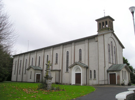 Catholic Church of Saint Patrick and Saint BrigidChurch/chapel · 1202 yd
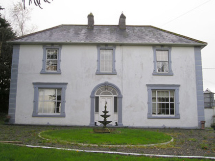 Ballinlough HouseHouse · 1.0 miCarrickittle RockCastle, unclassified · 1.6 mi
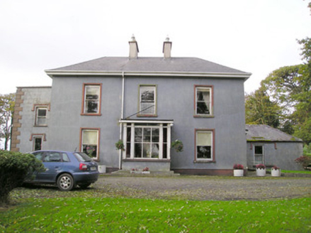 Cloverfield HouseCountry house · 2.3 mi
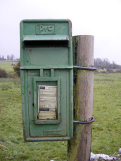 post box2.5 mi
 Castle (in ruins)Castle, tower house · 6.7 mi
 Grave YardGraveyard · 10.0 mi
 SlievereaghMountain / peak · 10 mi
 Ladys WellHoly well · 11 mi
 CarrigeenamronetyMountain / peak · 16 mi
More archaeology and monuments in County Limerick · All of County Limerick
What do you know about this place?