
What is recorded here
From the National Monuments Service (Archaeological Survey of Ireland) record ME049-020
Places near here
Photo credits
- Maker not stated on source page, www.geograph.ie
- National Inventory of Architectural Heritage
- Maker not stated on source page, ru.pinterest.com
- Ben Brooksbank, Wikimedia Commons · CC BY-SA 2.0
- Maker not stated on source page, www.irishamericanmom.com
- Kmcnamee, Wikimedia Commons · CC BY-SA 4.0
- Kmcnamee / Wikimedia Commons, commons.wikimedia.org
 Rodanstown C of I Parish Church, site ofRuins · 341 yd
Explorer Tom Rodanstown C of I Parish Church, Site of in County Meath is where a giant once sneezed so hard he blew the roof off, or…
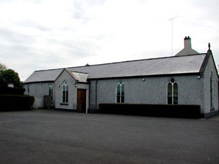 Catholic Church of the AssumptionChurch/chapel · 1.3 mi
Explorer Tom Catholic Church of the Assumption would bring its own silence to any party, which is rude but effective. That…
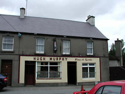 Hugh MurphyHouse · 1.3 mi
Explorer Tom Hugh Murphy in Kilcock is named after a man who probably started a feud over a misplaced fence. The ground floor looks…
 Coffin-resting stone in KilcockCoffin-resting stone · 1.3 mi
Explorer Tom Coffin-resting stone in Kilcock got used because people wanted to pay before the burial happened. It’s a block of stone…
 The ShrubberyHouse · 1.3 mi
Explorer Tom The Shrubbery in Kilcock looks like it's trying to outgrow its own shadow. Those wings are bigger than the main house…
 Saint Coca's Catholic ChurchChurch/chapel · 1.4 mi
Explorer Tom Saint Coca's Catholic Church in Kilcock once smuggled entire crates of chocolate through the altar during the famine…
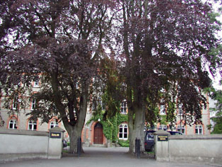 ShalomConvent/nunnery · 1.4 mi
Explorer Tom Shalom in Kilcock is a convent with a hidden message written in its stonework, and it’s probably just complaining about…
 gates/railings/walls1.4 mi
Explorer Tom Gates in Kilcock are locked in a bitter feud with the rain and losing spectacularly on Mill Lane. The arch insists it's…
 milestone/milepost1.4 mi
Explorer Tom Milestone in Kilcock is being claimed as an invention by a local who definitely didn’t build it. It’s just a rock with…
 Fairy fort / earthen ringfort in BarrockstownFairy fort / earthen ringfort · 1.4 mi
Explorer Tom Fairy fort / earthen ringfort in Barrockstown nearly made it famous before someone re-cut the drain and ruined the…
 Kilcock GAA pitchGAA ground · 1.7 mi
 Kilcloon, Blackhall GaelsGAA ground · 2.3 mi
More archaeology and monuments in County Meath · All of County Meath

What do you know about this place?Tap to add a comment or ask a question