
What is recorded here
From OpenStreetMap (© OpenStreetMap contributors) n4258704351
Places near here
Photo credits
- P L Chadwick, Geograph · CC BY-SA 2.0
- P L Chadwick, Wikimedia Commons · CC BY-SA 2.0
- Colin Park, Geograph · CC BY-SA 2.0
- Mike Searle, Wikimedia Commons · CC BY-SA 2.0
- National Inventory of Architectural Heritage
- N Chadwick, Geograph · Creative Commons Attribution-ShareAlike 2.0
- Sitomon, Wikimedia Commons · CC BY-SA 2.0
- dalvenjah on Flickr, Wikimedia Commons · CC BY-SA 2.0
 Bonane Heritage ParkMuseum · 1.0 mi
 CrannogHeritage attraction · 1.2 mi
 KnocknamanaghMountain / peak · 1.3 mi
 Knockboy North TopMountain / peak · 2.5 mi
 The Priests LeapViewpoint · 2.7 mi
 Battle of CallannBattle · 4.6 mi
Explorer Tom Battle of Callan in Kerry suspects the postman is spying on its grave marker. Donal fell here, so it’s got a lot of pride and very little patience. Best visited with a curious kid and no timetable.
Callan Battlefield (Site of)Battlefield · 4.6 mi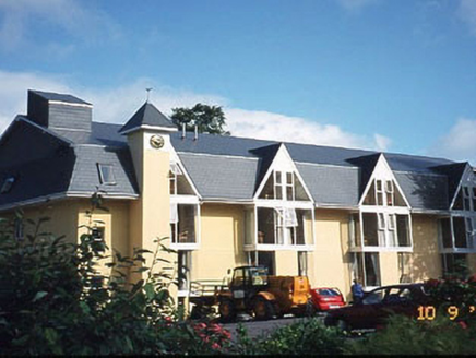 Riversdale HouseHouse · 4.7 mi
Explorer Tom Riversdale House gave up chocolate for Lent but kept its triple-gable attitude. Built in 1880, it now runs as a hotel for people who like old charm. Give it a pat on the way past, it's had a long life.
 Kenmare BridgeBridge · 4.8 mi
 European Yew4.8 mi
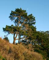 Monterey Pine5.0 mi
Explorer Tom A Monterey Pine in County Kerry claims it was friends with a famous singer who got lost here. The bird population is very skeptical about this story. Go back in winter, it's a different animal.
 Graveyard5.0 mi
Explorer Tom Graveyard in Killowen would describe the 1800s to a teenager as ‘slow Wi-Fi’. It’s still standing strong while everything else crumbles around it. Visit, then text me what you think. I'll pretend to read it.
More mountains and hills in County Kerry · All of County Kerry

What do you know about this place?Tap to add a comment or ask a question