
What is recorded here
From OpenStreetMap (© OpenStreetMap contributors) n5328114010
Places near here
Photo credits
- Newbert12, Wikimedia Commons · CC BY-SA 4.0
- Maker not stated on source page, en.wikipedia.org
- National Inventory of Architectural Heritage
- Dr Wotsit, Wikimedia Commons · CC BY-SA 3.0
- Michael Earnshaw, Geograph · CC BY-SA 2.0
- dalvenjah on Flickr, Wikimedia Commons · CC BY-SA 2.0
- Maker not stated on source page, www.irishamericanmom.com
- Kahuroa, Wikimedia Commons · Public domain
- Patrice78500, Wikimedia Commons · Public domain
- Alan Reid, Geograph · CC BY-SA 2.0
- Espresso Addict, Geograph · CC BY-SA 2.0
 Owenduff BridgeBridge · 1.2 mi
Explorer Tom Owenduff Bridge has a prophecy that says it will turn into gold on a Tuesday, but nobody believes it because Tuesdays…
 Stone row in Gleann Eidhneach (par. Baile Na Cille)Stone row · 1.5 mi
Explorer Tom Stone row in Gleann Eidhneach is a line of rocks that probably just wanted to sit together. Since we have no details, I…
Stone row in Gleann Eidhneach (par. Maigh Rois)Stone row · 1.6 miExplorer Tom Stone row in Gleann Eidhneach is six boulders lined up like they're waiting for a bus that never comes. They overlook a…
 bridge1.7 mi
Explorer Tom Bridge in Gleninagh is sick of people asking if it can hold a bus; the answer is yes, but it’s tired of them. It’s got…
 LetterbreckaunMountain / peak · 3.4 mi
Explorer Tom Letterbreckaun rises above Connemara's Inagh Valley with a name long enough to warm up your legs. This is Binn…
 Letterbreckaun ne TopMountain / peak · 3.5 mi
Explorer Tom Letterbreckaun NE Top thinks Dublin tourists are just people who forgot their sense of direction and their dignity on…
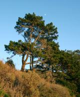 Monterey Pine3.8 mi
Explorer Tom Monterey Pine in County Galway once saw a fox try to climb it but get stuck halfway up because the branches were too…
 The WaterfallVisitor information · 4.2 mi
Explorer Tom The Waterfall is planning to spend its lotto win on a very expensive pair of swim trunks and a vacation to the moon…
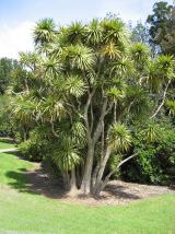 Cabbage tree4.6 mi
Explorer Tom Cabbage tree in County Galway looks like it’s waiting for a bishop who refused to visit because the leaves were too…
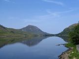 Binn GhuaireMountain / peak · 4.8 mi
Explorer Tom Diamond Hill glitters, but I have found no jeweller at the top. Binn Ghuaire, better known as Diamond Hill, rises 442…
 Glassilaun BeachBeach / strand · 5.4 mi
Explorer Tom Glassilaun Beach lies near the mouth of Killary Harbour, where white sand opens towards the water and Mweelrea rises…
 Lettergesh BeachBeach / strand · 5.5 mi
Explorer Tom Lettergesh Beach on the Renvyle Peninsula spreads its sand beneath a grand Connemara skyline, with Mweelrea across the…
More mountains and hills in County Galway · All of County Galway

What do you know about this place?Tap to add a comment or ask a question