What is recorded here
From OpenStreetMap (© OpenStreetMap contributors) n672265744
Places near here
Picture notes
- Computer-made picture. It does not show this monument.
- Computer-made picture. It does not show this playground.
- National Inventory of Architectural Heritage
- F. Elrington Ball, Wikimedia Commons · Public domain
- Amir Mohammad Saeid, Wikimedia Commons · CC BY-SA 4.0
 Tower (in ruins)Gatehouse · 108 ydTom: I’m here to help · Computer-made picture. It does not show this monument.
Explorer Tom Gatehouse in Ballymount Great was built by Sir William Parsons in 1622 to keep out the riffraff. Rumour has it he smuggled contraband cheese through a secret panel. Toast it with a cup of tea and move on to the next.
 Designed landscapeDesigned landscape, belvedere · 124 ydTom: I’m here to help · Computer-made picture. It does not show this monument.
Explorer Tom Designed landscape in Ballymount Great is an 18th-century folly turret sitting on top of an old barrow. It’s a small stone tower that thinks it’s very important. Best visited with a curious kid and no timetable.
 Ballymount PlaygroundChildren's playground · 796 ydTom: I’m here to help · Computer-made picture. It does not show this playground.
Explorer Tom Ballymount Playground in County Dublin is where the tiny tyrants rule. I bet they’ve already claimed the swings as their own. Bow to them, yeah?
 Children's playground853 ydTom: I’m here to help · Computer-made picture. It does not show this playground.
Explorer Tom Children's playground in County Dublin is open and buzzing with energy. I bet the monkey bars are actually bridges to other countries if you cross them fast enough. Try it.
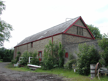 Newlands FarmAnimal house · 1137 yd
Explorer Tom Newlands Farm is a byre that cares about aesthetics more than your average cow shed. The bad poem someone wrote about it probably rhymed 'moo' with 'do.' Minimize your expectations and maximize your admiration for the detail.
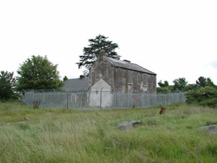 White HallFarm house · 1238 yd
Explorer Tom White Hall is a derelict farm house where Katherine Tynan was born, which makes it historic but also kind of sad because it’s falling apart. The roof is plastic and the windows are blocked, so it looks like it’s giving up on life right now.
 Belgard RoadMemorial · 1509 yd
Explorer Tom Belgard Road in County Dublin was opened by big wigs in 1981, so walk along it and feel important because you’re treading on ground that had a ceremony.
 Belgard CastleCastle · 1.1 mi
Explorer Tom Belgard Castle in County Dublin is sitting there looking all mysterious and ancient. No one seems to know its secrets, so I'll just pretend I do while we walk past it.
 CastleCastle, unclassified · 1.2 mi
Explorer Tom Castle in Clondalkin is Tully’s Castle, a narrow 16th-century tower with crenellations right on Monastery Road. It’s in state care, so it’s basically a celebrity that can’t leave the house. Ring your granny and tell her where you are before she worries about the round tower.
Fitwalk CircuitWalking route · 1.2 miExplorer Tom Another Fitwalk Circuit? Dublin really loves its repetitive cardio. The YouTube caption says Bachelor's Walk, but let's keep the bachelorhood to a minimum. Snap a sweaty selfie!
Mayor's Mile (Finsish)Visitor information · 1.3 miExplorer Tom Mayor’s Mile (Finsish) is where the fun ends and the reality sets in. You’ve walked far enough, now go buy a pint and feel accomplished.
Tymon Park Yellow SlíWalking route · 1.3 miExplorer Tom Tymon Park Yellow Slí in County Dublin is hiding in plain sight. I suspect the yellow paint has faded into the grass. Check the address and send me a quick selfie!
More castles and forts in County Dublin · All of County Dublin
What do you know about this place?Tap to add a comment or ask a question