
What is recorded here
From OpenStreetMap (© OpenStreetMap contributors) w1144455023
Places near here
Picture notes
- National Inventory of Architectural Heritage
- Computer-made picture. It does not show this playground.
- F. Elrington Ball, Wikimedia Commons · Public domain
- Amir Mohammad Saeid, Wikimedia Commons · CC BY-SA 4.0
- Paul Johnston-Knight, Wikimedia Commons · CC BY-SA 2.0
- Jo and Steve Turner, Geograph · CC BY-SA 2.0
- Ian Paterson, Geograph · CC BY-SA 2.0
- 瑞丽江的河水, Wikimedia Commons · CC BY-SA 4.0
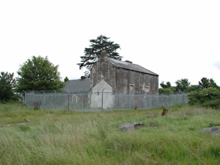 White HallFarm house · 519 yd
Explorer Tom White Hall is a derelict farm house where Katherine Tynan was born, which makes it historic but also kind of sad because it’s falling apart. The roof is plastic and the windows are blocked, so it looks like it’s giving up on life right now.
 Children's playground695 ydComputer-made picture. It does not show this playground.
Explorer Tom Children's playground in County Dublin is open and buzzing with energy. I bet the monkey bars are actually bridges to other countries if you cross them fast enough. Try it.
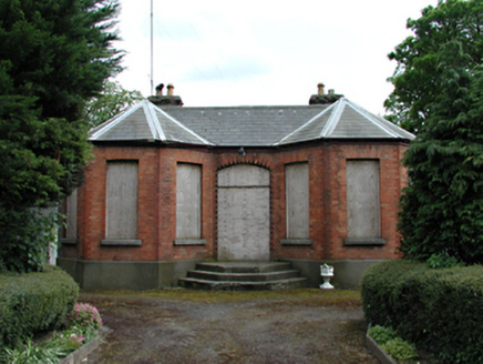 Newlands FarmFarm house · 705 yd
Explorer Tom Newlands Farm is an unoccupied red brick beauty from 1860 with a bow front added later. It’s charmingly boarded up, sitting proudly on Naas Road next to its animal shed sibling. Take a picture of those stone sills, they’re looking lonely!
 Belgard RoadMemorial · 919 yd
Explorer Tom Belgard Road in County Dublin was opened by big wigs in 1981, so walk along it and feel important because you’re treading on ground that had a ceremony.
 Belgard CastleCastle · 1184 yd
Explorer Tom Belgard Castle in County Dublin is sitting there looking all mysterious and ancient. No one seems to know its secrets, so I'll just pretend I do while we walk past it.
Veronica Guerin memorialMemorial · 1689 ydExplorer Tom The Veronica Guerin memorial in County Dublin is right there in the Dubhlinn Gardens, looking very determined about getting her message across. It’s a bit of a double entry for us, but she deserves the extra attention. Tell her Tom said hi!
 CastleCastle, unclassified · 1689 yd
Explorer Tom Known as Tully's Castle, this narrow sixteenth-century tower survives on the south side of Monastery Road in Clondalkin.
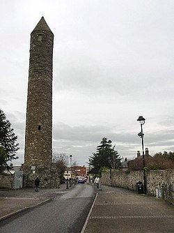 Clondalkin Round TowerHeritage attraction · 1.2 mi
Explorer Tom Clondalkin Round Tower in County Dublin is 84 feet high and has a conical cap like a wizard's hat. It's from the 8th century, so it's seen some things. Take a picture of the top!
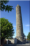 Round Tower1.2 mi
Explorer Tom Round Tower in Clondalkin. This tower has been standing since the seventh century and survived Viking raids! I’m impressed it’s still upright after so much historical drama.
 The Round TowerVisitor information · 1.2 mi
Explorer Tom The Round Tower in Clondalkin is 84 feet high and has original stairs. It's been a refuge since the 10th century. Grab a photo of the top for me!
Main ReceptionVisitor information · 1.3 miExplorer Tom Main Reception is just a door with a sign on it, which is basically what most of Dublin feels like anyway. Knock twice if you feel brave.
 Font in TallaghtFont · 1.5 mi
Explorer Tom Font in Tallaght. Known as St. Maelruan's Griddle and Loaf, this basin has uneven sides. I can almost smell the bread baking! If it baked a loaf, it must have been a very heavy, granite one.
More things to do in County Dublin · All of County Dublin
What do you know about this place?Tap to add a comment or ask a question