Places near here
Photo credits
- National Inventory of Architectural Heritage
- Picture: Pinterest photograph
- Mike Searle, Wikimedia Commons · CC BY-SA 2.0
- Colin Park, Geograph · CC BY-SA 2.0
- Rasbak, Wikimedia Commons · CC BY-SA 3.0
- Paul Evans from London, United Kingdom, Wikimedia Commons · CC BY 2.0
- kevin higgins, Geograph · CC BY-SA 2.0
- kevin higgins, Wikimedia Commons · CC BY-SA 2.0
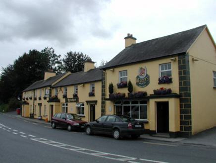 court house170 yd
Explorer Tom Court house in Curtiswood on Ballymacarbry reviews every visitor who walks past with a stern frown and a silent deduction. It’s one of the earliest civic buildings here, so it thinks it has the authority to judge your outfit too. You’ve been judged, and you failed slightly, I think.
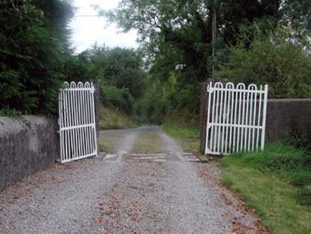 NirevaleGates/railings/walls · 536 yd
Explorer Tom Nirevale in Ballymacarbry is a gateway that has had so many names it suffers from identity crisis and mild confusion. It incorporates early wrought iron gates that look like they’re dancing slightly out of step. Call it by its current name very confidently!
CairnCairn, clearance cairn · 948 ydExplorer Tom Clearance cairns in Graignagower are terrible at parties because they only bring rocks and no wine. They’re just sitting there clearing the fields like they’ve got nothing better to do with their lives. A proper spot for a flask of tea and a big think.
East Munster WayWalking route · 3.4 miExplorer Tom East Munster Way gets absolutely pelted by the wind because it has the audacity to exist in open space without an umbrella or a sense of self-preservation. It’s basically a giant funnel for bad weather, collecting every gust and turning them into personal insults against your hairdo. Practise your Irish on it, it won't correct you.
 Carey's CastleCastle · 3.7 mi
Explorer Tom Carey's Castle in County Waterford has survived everything except your average zombie apocalypse, mostly because they’re too slow to get through the door. The entrance is still standing and judging your posture. Look serious, nod slowly, you're basically an expert now.
Carey's Castle WoodsVisitor information · 4.0 miExplorer Tom Carey's Castle Woods is playing hard to get in County Waterford. When nobody’s looking, it probably rearranges its own trees just to confuse the locals who think they know their way around. It’s a whole forest of secrets that won't even tell you what time it is. Leave nothing but footprints and a bad pun.
 Castle, Kilmanahan CastleCastle, tower house · 5.2 mi
Explorer Tom Castle, Kilmanahan Castle would survive a zombie attack by hiding in its own foundations and hoping they’re too busy eating each other. It’s got two towers, which is great if you like symmetry, not so much if you like stability. Tell your mates you found it first.
 KnocksheegownaMountain / peak · 5.4 mi
Explorer Tom Knocksheegowna has a curse that only affects people who don't wave when they pass by. You have to be polite or you'll trip over roots for a week afterwards. It's very particular about manners and etiquette up there. If it rains, blame me.
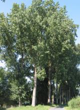 Hybrid Black Poplar5.5 mi
Explorer Tom Hybrid Black Poplar in County Tipperary is having a massive feud with the next village over because they stole one of its acorns last autumn. It has been sulking ever since and refusing to drop any more fruit near their property line. Pick a stone, any stone, and invent its biography.
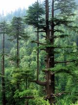 Deodar Cedar5.6 mi
Explorer Tom Deodar Cedar in County Tipperary keeps getting picked on by the wind because its pointy top looks exactly like a giant finger pointing at the sky in accusation. It stands there looking sharp and serious, while the breeze just whistles past it as if to say 'try again.' Get there early and have it all to yourself.
 SeefinMountain / peak · 6.0 mi
Explorer Tom Seefin is where the rabbits go to judge your outfit and your life choices without saying a word. They look at your boots with such disappointment that you’ll want to change them immediately on the spot. Pretend it's yours and plan the housewarming.
 Standing StoneRuins · 6.8 mi
Explorer Tom This unnamed Standing Stone is haunted by a ghost who is far too lazy to actually do anything, so he just stands there looking confused. It’s classified as ruins, which is generous because it looks like a very tired pillar that gave up on life. Perfect detour when the satnav has a meltdown.
More historic places in County Waterford · All of County Waterford

What do you know about this place?Tap to add a comment or ask a question