Places near here
Photo credits
- National Inventory of Architectural Heritage
- Oliver Dixon, Geograph · CC BY-SA 2.0
- Mike Searle, Wikimedia Commons · CC BY-SA 2.0
- Mike Searle, Geograph · CC BY-SA 2.0
- Willow, Wikimedia Commons · CC BY 2.5
- JohnArmagh, Wikimedia Commons · CC BY-SA 3.0
- Gleneary, Wikimedia Commons · CC BY-SA 4.0
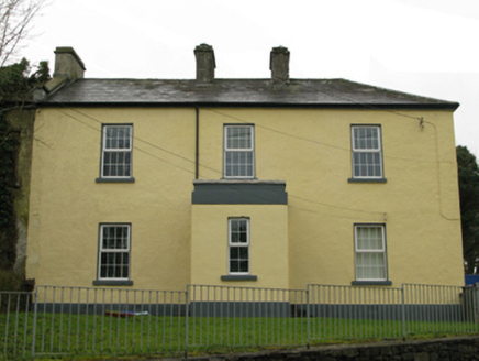 Ballyglass Garda Síochána StationGarda station/constabulary barracks · 89 yd
Explorer Tom Ballyglass Garda Síochána Station is where Sergeant Hickie and his mates spent their days doing absolutely nothing. It’s a compact, symmetrical building that looks like it’s been waiting for a crime to happen since 1901. The symmetry is so perfect it’s almost suspicious. Tip your hat if you see any guards inside!
IndicatedFairy fort / earthen ringfort · 663 ydExplorer Tom Fairy fort or earthen ringfort in Kilgreana has an imaginary fan club that meets every Tuesday night to discuss its structural integrity with great passion. The bank is only thirty centimeters high, which is a bit of a letdown if you were expecting a fortress, but it’s still standing. It’s got that 'I’m tired' energy that makes you want to sit down and take a nap instead of exploring. Stand
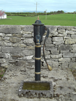 water pump1385 yd
Explorer Tom Water pump in Knockatotaun [carr. by.] is standing there looking like it’s lost in thought about the concept of water. It’s a cow-tail pump, which is a weird name for something that’s basically a metal stick with ambition. I suspect it’s just waiting for a rainstorm so it can feel relevant again. Don’t knock on it; it’s shy and has terrible manners.
 Moore Hall Forest TrailWalking route · 3.0 mi
Explorer Tom Moore Hall Forest Trail is hiding treasure, but don’t get your hopes up, it’s definitely just an old biscuit tin with rust on it. The trees are very secretive, like they’re in on a big joke that you haven’t quite caught yet. Spot the oldest stone and give it a name.
_-_geograph.org.uk_-_4072916.jpg/250px-Castles_of_Connacht,_Doonamona,_Mayo_(1)_-_geograph.org.uk_-_4072916.jpg "Photo: Mike Searle, Wikimedia Commons · CC BY-SA 2.0") Doonamona CastleCastle · 3.1 mi
Doonamona CastleCastle · 3.1 miExplorer Tom Doonamona Castle’s first owner probably planned his escape by buying the most expensive pair of boots available at the time. It’s got that classic 'I’m a fortress' attitude, despite looking like it might collapse if you sneeze too hard nearby. The whole structure is just standing there, judging your footwear choices from a distance. Sit on a wall near it and pretend you're in a painting.
Creevagh IslandIslet · 3.2 miExplorer Tom Creevagh Island hears everything through the walls because there aren’t really any walls, just vibes and wet rocks. It’s got that 'I’ve seen things' energy without actually saying what they were. The name is lovely but hard to spell, which keeps the tourists guessing for a while. Go before the tourists find out it’s mostly mud; you’ll have the place to yourself and your secrets.
Connors IslandIslet · 3.2 miExplorer Tom Connors Island has an unlikely celebrity friend: the wind, which visits every day and never says hi. It’s out here taking a splash in the Atlantic like it owns the place. The name suggests family history, but mostly it just suggests a lot of wet feet for anyone visiting. Go on a wet day; it suits the mood and makes you feel like a rugged hero.
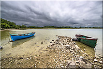 Moore Hall ForestForest · 3.2 mi
Explorer Tom Moore Hall Forest in County Mayo is basically having an identity crisis because it’s next to a lake and thinks it’s one too. It’s got that look of 'I used to be something, now I’m just wet.' If it could talk to its younger self, it’d say, 'Stop trying so hard, mate.' Look serious, nod slowly, you're basically an expert now.
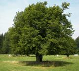 European hornbeam3.8 mi
Explorer Tom European hornbeam once got into a bidding war with a very determined cow who wanted to buy its bark for chewing. The tree won, obviously, because it couldn't move and the cow was hungry. Best visited with a curious kid and no timetable.
 Castle CarraCastle · 3.9 mi
Explorer Tom Castle Carra is where Saint Patrick probably looked around and said, 'This is too much stone for one day' and moved on. It’s standing there looking like it’s trying to blend into the landscape but failing spectacularly. The name sounds like a car brand that went out of fashion in the nineties. Go before the tourists find out.
 Round Tower4.9 mi
Explorer Tom Round Tower in Balla is standing there with no roof, looking utterly confused about the weather situation. There’s a curse that only affects people who don't wave at it. Bring a jacket, it's never as warm as I promise.
 Ballintubber AbbeyHeritage attraction · 5.0 mi
Explorer Tom Ballintubber Abbey has a secret talent for making everyone feel like they’re the only ones who understand its deep, ancient wisdom and profound silence. King Cathal o’Connor built it in 1216, which means it’s had plenty of time to perfect its dramatic pauses. Great spot to propose. Or at least to propose lunch first.
More historic places in County Mayo · All of County Mayo

What do you know about this place?Tap to add a comment or ask a question