What is recorded here
Ballygibbon Castle vanished before the nineteenth century, leaving only a ruined shadow in a Civil Survey and a house that may have swallowed its stones. The occupant denies any castle memory, yet the building still stands on a slight rise where the old structure likely fell. Perhaps the family simply stopped remembering the walls because the walls stopped existing, turning a local landmark into an ordinary domestic address.
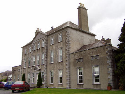
Situated on a slight rise of ground in undulating countryside. The Civil Survey (1654-6) mentions 'an old ruined castle' in the parish of Ballygibbon (Simington 1934, vol. 2, 222-3). Ballygibbon House, a two-pile, five-bay building of probable nineteenth-century date, may stand on the site of this castle. According to the occupant there is no early fabric or tradition of a castle associated with this house. The interior was not viewed. Ballygibbon Castle is depicted on the 1654-7 Down Survey map of Ballygibbon parish (NLI MS721). On this map it is shown located E of Ballygibbon Church (TN015-102001-) in the E quadrant of the townland close to woody bogland. The precise location of this castle within the townland of Ballygibbon has not been identified.
The above description is derived from 'The Archaeological Inventory of County Tipperary. Vol. 1 - North Tipperary' compiled by Jean Farrelly and Caimin O'Brien (Dublin: Stationery Office, 2002). In certain instances the entries have been revised and updated in the light of recent research.
Date of upload/revision: 22 September 2008
The monument record does not grant public access. Check the route and ask the landowner before entering private land.
- What survives
- Recorded monument
Places near here
 Enclosure in BallygibbonEnclosure · 681 yd
 Ballygibbon Church (in ruins)Church · 770 yd
 Enclosure in MiddlewalkEnclosure · 1324 yd
 Beechwood Housecountry house · 1736 yd
 Bawn in Graigue Upper (ardcrony Par.)Bawn · 1751 yd
 Ballycapple WoodForest · 1.3 mi
 James Devaney MemorialMemorial · 1.3 mi
 CastleCastle, tower house · 1.7 mi
 Thomas MacDonagh Heritage CentreMuseum · 3.8 mi
 MacDonagh HouseMemorial · 3.8 mi
 Old BarracksHeritage attraction · 4.4 mi
 Knockanacree WoodForest · 4.5 mi