DDiscover AloneMapAbout

Ballyduff House

House
Ballyduff House
Photo: National Inventory of Architectural Heritage · Report the wrong picture

This does not grant access. Most recorded buildings are privately owned; view them only from public ground unless the owner allows entry.

What do you know about this place?Tap to add a comment or ask a question

What you write will be public.

What is recorded here

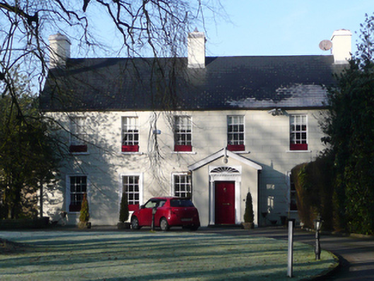
Detached five-bay two-storey house, built c. 1780 and possibly containing earlier fabric, having projecting gable-fronted single-bay single-storey entrance porch offset to the north side of the centre of the entrance front (east), added c. 1870, two-storey return to rear (west), two-bay single-storey extension to the…

Read the whole record
Detached five-bay two-storey house, built c. 1780 and possibly containing earlier fabric, having projecting gable-fronted single-bay single-storey entrance porch offset to the north side of the centre of the entrance front (east), added c. 1870, two-storey return to rear (west), two-bay single-storey extension to the north, and with single-storey outbuilding attached to the south. Pitched natural purple slate roof with three smooth rendered ruled-and-lined chimneystacks (one to centre and one to either gable end) with cornice coping, and having cast-iron rainwater goods. Hipped and pitched roof to north extension. Rusticated smooth rendered ruled-and-lined walls with roughcast rendered walls to extension to north and to return to rear. Square-headed window openings with stone sills, six-over-six pane timber sliding sash windows, and with architraved surrounds to ground floor openings. Square-headed doorway to front face of porch having timber panelled door with bolection mouldings, spoked overlight, and with doorcase comprising Doric columns supporting entablature over with dentilated cornice and with floral motifs to frieze. Set back from road in mature grounds to the west of the centre of Lifford. Aligned at a right-angle to road-alignment. Range of single-storey outhouses adjoining to south having pitched corrugated-metal and natural slate roofs, smooth rendered and brick walls and square-headed openings. Rubble stone boundary walls to the north boundary to rear (west), roughcast rendered walls to the north boundary to front (east). Gateway to the south-east.
This substantial and well-proportioned house retains much of its original form and character despite some modern alterations. Its visual appeal and integrity are enhanced by the retention of salient fabric such as the timber sliding sash windows while the elegant doorway to the later porch with Doric columns, entablature with foliate motifs and a simple spoked fanlight over adds some decorative interest to the front elevation. This doorway may have been moved to its current location from the front of the house when the porch was constructed, c. 1860. The front elevation is further enlivened by the uniform classical Georgian proportions with regular window openings and spacing of chimneystacks, rusticated ashlar render, and by the architraved surrounds to the window openings at ground floor level. Although this building is of a late eighteenth-century architectural character, it reputedly retains fabric from an earlier house or houses to site dating back to the seventeenth century (Rowan 1979). The relationship of this building with the adjacent road (aligned at a right-angle), it narrow plan, and the steep roof all hints that it may contain earlier fabric. Dr. Robert Little (1814-81), Doctor at the County Infirmary at Lifford, lived here for a period in the early 1840s before moving to or building Combermore (see 40835017). It was later apparently the home of a William McCrea Knox (died 1878) who left an estate valued at £6,000. This building was the home of a John Cochrane J.P. in 1881 (he later moved to nearby Combermore), and a Capt. John Thompson in 1894, adjunct at the military barracks at Lifford (Slater’s Directories). Occupying attractive mature grounds, this building is an integral element of the built heritage of Lifford, adding interest to the streetscape to the west of the centre. The adjoining outbuildings to the south and the surviving sections of rubble stone boundary wall add to the setting and context, and complete this composition.

From the Buildings of Ireland (National Inventory of Architectural Heritage) record 40835019

Places near here

Photo credits
  • National Inventory of Architectural Heritage
  • Kenneth Allen, Geograph · CC BY-SA 2.0
  • Maker not stated on source page, commons.wikimedia.org
  • Kenneth Allen, Wikimedia Commons
  • Maker not stated on source page, fi.pinterest.com
  • Kenneth Allen, Wikimedia Commons · CC BY-SA 2.0
  • Rod Allday, Wikimedia Commons · CC BY-SA 2.0
  • Maker not stated on source page, www.flickr.com
Ballyduff CottageHouse · 153 yd

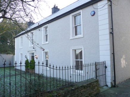
Explorer Tom Ballyduff Cottage was built around 1830. The survey records three chimneys across its roof: one at each end and one in…
CombermoreOutbuilding · 178 yd

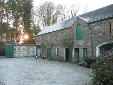
Explorer Tom Combermore’s outbuildings have loop hole openings that make me wonder if the horses were training for medieval combat.…
Lifford Army BarracksSchool · 182 yd

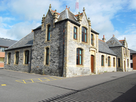
Explorer Tom Lifford Army Barracks is where a school dared to demand university standard lessons in 1879. Miss Prior left money for…

post box196 yd

Explorer Tom Post box in Lifford has a P&T motif on its base that looks like it was written by a very fancy, sleepy scribe. I reckon…

Standing stone in Townparks (clonleigh South Ed)Standing stone · 258 yd

Explorer Tom Standing stone in Townparks would win the county fair’s 'Most Invisible' category without even trying, since there’s no…

LiffordHistoric town · 340 yd

Explorer Tom Lifford sits where rivers meet and counties look across at each other, a location that gave this Donegal town plenty of…

Standing stone in LiffordStanding stone · 393 yd

Explorer Tom Standing stone in Lifford is totally gone now, which is wild. It was marked on the 1st edition of the OS 6-inch map, so…

Battle site: battle of the fords, Central crossing, 1689 in Magirr; Town Parks of StrabaneBattle site: battle of the fords, Central crossing, 1689 · 519 yd

Explorer Tom The central crossing of the Battle of the Fords in Strabane is still listening for the echo of boots splashing through…

Let the Dance BeginSculpture · 1067 yd

Explorer Tom Let the Dance Begin thinks the road leading to it is an insult to its artistic sensibilities, which is fair enough for…

Abercorn FactoryHeritage attraction · 1674 yd

Explorer Tom Abercorn Factory is like the uncle at a wedding who knows how to make shirts but can’t stop talking about his days in…

Castle in Town Parks of StrabaneCastle · 1751 yd

Explorer Tom This castle in Strabane Town Parks would tell you in a job interview that it has excellent stability and long-term…

Patrick Street GraveyardGraveyard · 1.1 mi

Explorer Tom Legend says Patrick Street Graveyard is connected by a secret tunnel straight to the local pub, so the dead can check…

More historic places in County Donegal · All of County Donegal

Add to this placeAdd a picture Add a detailed tip Add a story

Explore the map1,095,414 places to discover

Next place · or swipeBallyduff Cottage