What is recorded here
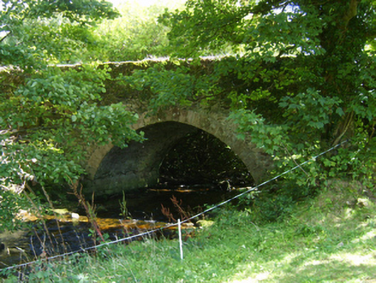
Single-arch road bridge over river, extant 1839. Creeper- or ivy-covered walls with overgrown coping to parapets. Single segmental arch between creeper- or ivy-covered battered piers with lichen-spotted granite ashlar voussoirs. Sited spanning Urrin River with unkempt banks to river.
A bridge representing an integral component of the civil engineering heritage of north County Wexford with the architectural value of the composition suggested not only by the silver-grey granite dressings demonstrating good quality workmanship, but also by the gentle "sweep" of the arch making a pleasing visual statement at a crossing over the Urrin River: meanwhile, a discreet benchmark remains of additional interest for the connections with cartography and the preparation of maps by the Ordnance Survey (established 1824).
From the Buildings of Ireland (National Inventory of Architectural Heritage) record 15701402
This does not grant access. Most recorded buildings are privately owned; view them only from public ground unless the owner allows entry.
Places near here
Photo credits
- National Inventory of Architectural Heritage
- Sarah777, Wikimedia Commons · Public domain
- kevin higgins, Geograph · CC BY-SA 2.0
- No machine-readable author provided. Voyager assumed (based on copyright claims)., Wikimedia Commons · CC BY-SA 3.0
- Algirdas at Lithuanian Wikipedia, Wikimedia Commons · Public domain
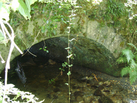 Cloroge BridgeBridge · 335 yd
 Ballycrystal HouseGates/railings/walls · 629 ydIndicatedEnclosure · 650 ydEmbanked enclosureFairy fort / earthen ringfort · 1085 yd
 Black Rock MountainMountain / peak · 2.5 mi
 KnockroeMountain / peak · 2.8 mi
 Mount LeinsterMountain · 3.3 miIrish Hangliding and Paragliding AssociationMemorial · 3.4 mi
 Pedunculate Oak3.6 miSt Bridget's WellSpring · 4.1 miCoonogue WoodForest · 4.2 mi1798 MemorialMemorial · 4.2 mi
More historic places in County Wexford · All of County Wexford
What do you know about this place?