Places near here
Photo credits
- National Inventory of Architectural Heritage
- Sciadopitys from UK, Wikimedia Commons · CC BY-SA 2.0
- Andreas F. Borchert, Wikimedia Commons · CC BY-SA 4.0
- Gerd Eichmann, Wikimedia Commons · CC BY-SA 4.0
- Willow, Wikimedia Commons · CC BY 2.5
- Sarah777, Geograph · CC BY-SA 2.0
- dougf, Geograph · CC BY-SA 2.0
- Enna, Wikimedia Commons · Public domain
- Alex Passmore, Wikimedia Commons · CC BY-SA 2.0
- Jonathan Billinger, Wikimedia Commons · CC BY-SA 2.0
- Ian Rob, Geograph · CC BY-SA 2.0
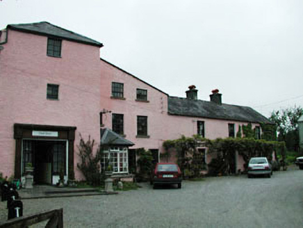 mill (water)1568 yd
Explorer Tom Mill in Timolin is still arguing with the village over who owns the sound of the water. It grinds its teeth every time a tractor goes by and refuses to back down. Find the spot where the river whispers secrets to the stones.
 Saint Mullin's Church (Timolin)Church/chapel · 1660 yd
Explorer Tom Saint Mullin's Church in Timolin has a retirement plan involving doing absolutely nothing while looking very dignified about it. It’s been here since before anyone remembered why they built it, so relax and enjoy the peace. Wave at the cows, they're the real staff.
 European Larch1.3 mi
 Stone CrossCross, High cross · 1.7 mi
Explorer Tom Stone Cross in Moone was moved inside because a fox took charge of the garden. It has biblical scenes that look more like a very confused family photo. Look for the ghost, then pretend you didn't.
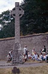 CrossCross, High cross · 1.7 mi
Explorer Tom Cross in Moone is built into a church wall and looks like it’s having a fit. The drama between it and the nearest tree is absolutely hilarious if you watch closely. Bring a jacket, it's never as warm as I promise.
 European ash3.1 mi
Explorer Tom European ash in County Kildare was saved by a hero nobody remembers, probably because he forgot his name. The tree doesn't care, it just loves the mystery. Find a local and ask them the real story, then come back and tell me.
 Tinoran HillMountain / peak · 3.2 mi
 Blackhall CastleCastle, tower house · 5.1 mi
_(page_1_crop).jpg/250px-Inch_Castle,_Co._Kildare,_1835_(IA_jstor-30003809)_(page_1_crop).jpg "Photo: Enna, Wikimedia Commons · Public domain") Inch CastleCastle, tower house · 5.2 mi
Inch CastleCastle, tower house · 5.2 miExplorer Tom Inch Castle in County Kildare started because two lads bet they could build it before lunch. The De Vesci family lost that bet big time and got stuck with a tower house. Get a photo with it before it gets a better agent.
 History of Moat of ArdscullVisitor information · 5.8 mi
 SugarloafMountain / peak · 9.7 mi
 Killeshin ChurchVisitor information · 13 mi
More castles and forts in County Wicklow · All of County Wicklow

What do you know about this place?Tap to add a comment or ask a question