What is recorded here
In improved pasture on a SSE-facing slope, with good views, especially to S and within an extensive multiperiod field system (CL009-059001-). Hachured and named ‘Ballybreen Fort’ on the 1842 ed. of the OS 6-inch map. Similarly named on the 1897 OS 25-inch map and depicted as an incomplete circle open to the NNW. A somewhat overgrown circular enclosure (int. dims. 25.75m) defined by grassed-over wall collapse (Wth c. 1m) surmounted by a drystone wall (H 1.5m), probably of a later date. Two partly blocked-up alcoves (L 1m; Wth 1m) are visible in inner wall-face at E. The interior slopes gently to the S. A curving bank (Wth 7m; H 0.8m) visible on Digital Globe (2011-2013) extends from S to W at a distance of c. 33m from S and c. 14m from W. Two modern gates in the E and W walls give access to the interior which is currently serving as a cattle paddock. A concentric wall 4m outside the perimeter of the enclosure wall forms an avenue possibly now used for separating livestock.
In improved pasture on a SSE-facing slope, with good views, especially to S and within an extensive multiperiod field system (CL009-059001-). Hachured and named ‘Ballybreen Fort’ on the 1842 ed. of the OS 6-inch map. Similarly named on the 1897 OS 25-inch map and depicted as an incomplete circle open to the NNW. A somewhat overgrown circular enclosure (int. dims. 25.75m) defined by grassed-over wall collapse (Wth…
From the National Monuments Service (Archaeological Survey of Ireland) record CL016-006
The monument record does not grant public access. Check the route and ask the landowner before entering private land.
- What survives
- Recorded monument
Places near here
Photo credits
- National Inventory of Architectural Heritage
- N Chadwick, Geograph · Creative Commons Attribution-ShareAlike 2.0
- Dan J J Kahn, Wikimedia Commons · CC BY-SA 4.0
- N Chadwick, Geograph · CC BY-SA 2.0
- Colin Park, Geograph · CC BY-SA 2.0
- Gordon Hatton, Geograph · CC BY-SA 2.0
- Roger Diel, Geograph · CC BY-SA 2.0
- Gordon Hatton, Wikimedia Commons · CC BY-SA 2.0
- Joseph Mischyshyn, Geograph · CC BY-SA 2.0
- P.hammer, Wikimedia Commons · CC BY-SA 3.0
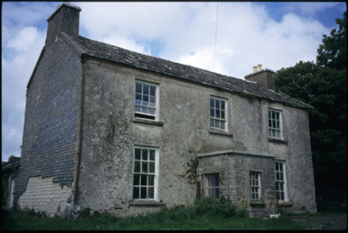 The DeaneryRectory/glebe/vicarage/curate's house · 430 yd
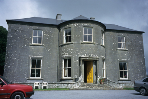 Ballykeel HouseCountry house · 1069 yd
 Graveyard1348 yd
 CrossCross, High cross · 1385 yd
 High CrossHeritage attraction · 1389 yd
 Burren Centre KilfenoraVisitor information · 1416 yd
 Smithstown Castle (in ruins)Castle, tower house · 1.4 miBallyteigue Nature ReserveNature reserve · 2.6 mi
 Ballyganner Castle (in ruins)Castle, tower house · 3.0 mi
.jpg/250px-Cahermacnaghten_(geograph_4680299).jpg "Photo: Gordon Hatton, Wikimedia Commons · CC BY-SA 2.0") Cahermacnaghten CashelHeritage attraction · 4.0 mi
Cahermacnaghten CashelHeritage attraction · 4.0 mi Famine MemorialMemorial · 4.9 mi
 Doolin CaveCave · 5.7 mi
More archaeology and monuments in County Clare · All of County Clare
What do you know about this place?