Places near here
Photo credits
- National Inventory of Architectural Heritage
- Eirian Evans, Geograph · Creative Commons Attribution-ShareAlike 2.0
- Kmcnamee, Wikimedia Commons · CC BY-SA 4.0
- Yablochko, Wikimedia Commons · CC0
- Tszabon, Wikimedia Commons · CC BY-SA 3.0
- Schcambo at English Wikipedia, Wikimedia Commons · Public domain
- Pierre Terre, Geograph · CC BY-SA 2.0
- Eric Barnes, Wikimedia Commons · CC BY 2.0
- Golfing in Ireland; photographer not stated, Source publisher
- JP, Wikimedia Commons · CC BY-SA 2.0
- Simon Mortimer, Geograph · CC BY-SA 2.0
- Rafesmar, Wikimedia Commons · CC BY-SA 4.0
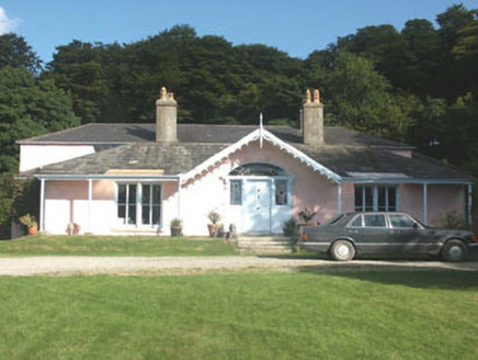 Lake Park HouseHouse · 1.0 mi
Explorer Tom Lake Park House in Carrigroe swears Queen Victoria stopped by for tea in 1845 and left her thimble behind. No one can…
 Saint Laurence's National SchoolSchool · 1.7 mi
Explorer Tom Saint Laurence's National School in Togher More is a 1923 building that suspects every postman is actually a spy sent…
 An Tochar GAAGAA ground · 1.8 mi
 Victor's WayHeritage attraction · 2.0 mi
Explorer Tom Victor's Way is home to a giant who only appears when you’re holding a half-eaten sandwich. The locals swear he’s been…
 Lough TayMountain lake · 2.0 mi
Explorer Tom Lough Tay has an imaginary twin across the sea that owes it rent money. The lake is just sitting there judging everyone…
 LuggalaMountain / peak · 2.2 mi
Explorer Tom Luggala in County Wicklow has a long-standing grudge with the weather because every time it tries to show off its view…
 J.b. Malone MemorialMemorial · 2.3 mi
Explorer Tom J.B. Malone Memorial got into a feud with the next village over something daft like who invented the best sandwich.…
 ScarrMountain / peak · 2.5 mi
Explorer Tom Scarr rises above Lough Dan with a ridge sharp enough to make the rest of Wicklow's rounded hills look as though they…
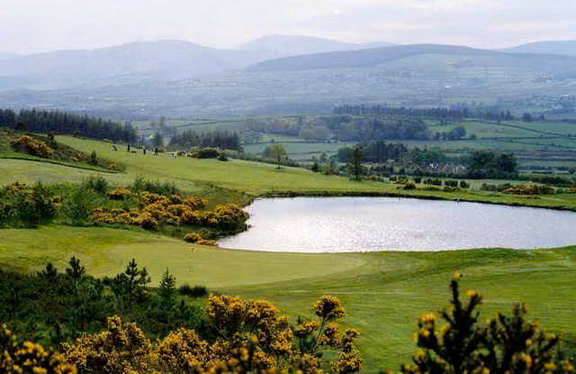 Roundwood Golf ClubGolf course · 4.2 mi
 Devil's Glen WaterfallWaterfall · 5.1 mi
Explorer Tom Devil's Glen Waterfall has a name fit for a villain's lair, yet its real trick is water and a Wicklow gorge working…
 Deerpark TrailWalking route · 5.3 mi
Explorer Tom Deerpark Trail is absolutely showing off its muscles in County Wicklow. I reckon when nobody's looking, it practices…
 CloigtheachRound tower · 5.3 mi
Explorer Tom Cloigtheach in Sevenchurches would tell you in a job interview that he has excellent stability and zero need for a…
More mountains and hills in County Wicklow · All of County Wicklow

What do you know about this place?Tap to add a comment or ask a question