What is recorded here
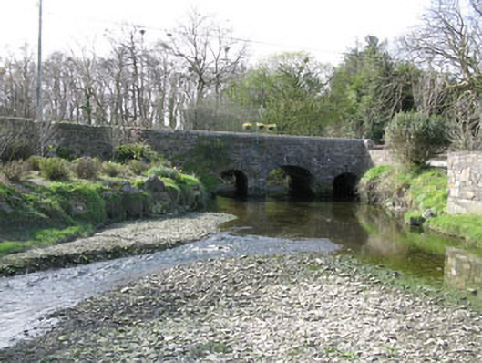
Triple-arch road bridge, built 1845, spanning Ballinadee Creek. Central camber-headed arch, flanked by smaller camber-headed arches having roughly dressed limestone voussoirs springing from rubble stone piers with V-cutwaters to west elevation of central piers . Tooled stone date plaque above keystone to central arch. Rubble stone spandrels with splayed abutments to south. Splayed rubble stone parapet walls with rendered coping.
A handsome bridge situated at the southern end of Ballinadee village, located at the highest point to which medium tides flow. It has an organised plan with a central arch flanked by two smaller ones, with V-cutwaters located to the upstream side to dissipate the power of the water.
From the Buildings of Ireland (National Inventory of Architectural Heritage) record 20911123
This does not grant access. Most recorded buildings are privately owned; view them only from public ground unless the owner allows entry.
Places near here
Photo credits
- National Inventory of Architectural Heritage
- Garry Dickinson, Geograph · CC BY-SA 2.0
- Wikipedian231, Wikimedia Commons · CC0
- Unknown author Unknown author, Wikimedia Commons · Public domain
- Mac McCarron, Geograph · CC BY-SA 2.0
- ME, Wikimedia Commons · CC BY-SA 3.0
- David Dixon, Geograph · CC BY-SA 2.0
- Hywel Williams, Geograph · CC BY-SA 2.0
- Mike Searle, Geograph · CC BY-SA 2.0
- Einaz80, Wikimedia Commons · CC BY-SA 4.0
 Annsville HouseHouse · 87 yd
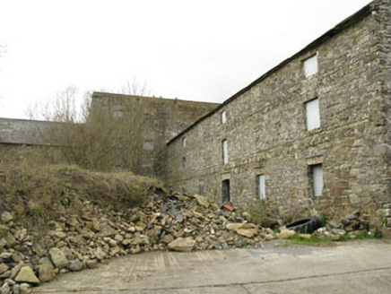 Ballinadee MillMill (water) · 112 yd
 Kilgobbin CastleCastle · 1.2 mi
 White Castle (in Ruins)House, fortified house · 2.5 mi
 The Moving StatueHeritage attraction · 3.1 mi
 Battle of KinsaleMajor battlefield · 4.1 mi
 Garranefeen StrandBeach / strand · 4.2 mi
 Desmond CastleMuseum · 4.4 mi
 World War I MemorialMemorial · 4.7 mi
 Trinity WellSpring · 4.9 mi
 James FortVisitor information · 4.9 mi
.jpg/250px-James_Fort_(Kinsale).jpg "Photo: Einaz80, Wikimedia Commons · CC BY-SA 4.0") Old FortBastioned fort · 5.0 mi
Old FortBastioned fort · 5.0 miMore historic places in County Cork · All of County Cork
What do you know about this place?