
More pictures of this place

What is recorded here
The story behind this place
From the Buildings of Ireland (National Inventory of Architectural Heritage) record 21513031
This does not grant access. Most recorded buildings are privately owned; view them only from public ground unless the owner allows entry.
Places near here
 Balls BridgeBridge · 2 yd
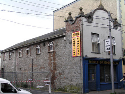 store/warehouse60 ydBurial ground in Limerick City,saint Francis AbbeyBurial ground · 71 yd
.jpg/250px-Limerick,_Fanning's_Castle_(2).jpg "Photo: GilPe, Wikimedia Commons · CC BY-SA 4.0") OutlinedCastle, tower house · 179 ydGrove IslandIslet · 228 yd
OutlinedCastle, tower house · 179 ydGrove IslandIslet · 228 yd Siege of LimerickSiege · 298 yd
 Siege of LimerickSiege · 298 yd
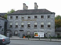 Hunt MuseumMuseum · 314 yd
 Saint Mary's CathedralHeritage attraction · 340 yd
 Merchants QuayQuay · 342 ydThe Singer from QuimperMemorial · 480 yd
 CastleCastle, ringwork · 557 yd
Pictures: Jamesanthonyohare, Wikimedia Commons · CC BY-SA 4.0; National Inventory of Architectural Heritage; GilPe, Wikimedia Commons · CC BY-SA 4.0; Henry Edward Doyle, Wikimedia Commons · Public domain; Charles Oliver Murray, Wikimedia Commons · Public domain; Roland Czaczyk ( FreeBird 19:17, 23 December 2006 (UTC)), Wikimedia Commons · Public domain; Sean.magner89, Wikimedia Commons · CC BY-SA 4.0; N Chadwick, Geograph · Creative Commons Attribution-ShareAlike 2.0; Colin Park, Geograph · CC BY-SA 2.0
More historic places in County Limerick · All of County Limerick
What do you know about this place?