What is recorded here
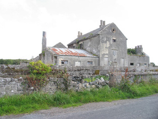
Situated in gently undulating terrain. Only the S façade of a late seventeenth/early eighteenth-century house (ext. dims.9.7m N-S; 15.1m E-W; wall T 0.7m) survives incorporated into the E end of a later nineteenth-century house. The early house was accessed from a first-floor door at the centre of the S wall with a stone stairs leading up to the entrance. Later rendering covers the cornicing and two strip pilasters visible at the W end of the external face of the S wall. The pilasters were constructed from roughly punch-dressed limestone with barely discernible drafted margins.
The above description is derived from 'The Archaeological Inventory of County Tipperary. Vol. 1 - North Tipperary' compiled by Jean Farrelly and Caimin O'Brien (Dublin: Stationery Office, 2002). In certain instances the entries have been revised and updated in the light of recent research.
Date of upload/revision: 22 September 2008
The monument record does not grant public access. Check the route and ask the landowner before entering private land.
- What survives
- Recorded monument
Places near here
 Ritual siteRitual site, holy tree/bush · 565 yd
 Tombrickan CastleCastle · 850 yd
 Kyle Parkhouse · 1071 yd
 Kyle Park Schoolschool · 1433 yd
 Enclosure in Rathmore (borrisokane Par.),tombrickaneEnclosure · 1564 yd
 Ballyfinboy Castle (in Ruins)Castle, tower house · 1.0 mi
 Borris WoodWood · 1.1 mi
 Grassy IslandIslet · 4.0 mi
 Brieny IslandIslet · 4.0 mi
 Carrickboy WoodForest · 4.5 mi
 Slevoir BayBay · 4.7 mi
 MacDonagh HouseMemorial · 6.7 mi